
This map was published in 2014 and shows all the nationalist and independence movements in Europe. It was created by The Department...
Interesting Maps (245 maps)

Illustrated map of La Gomera (2021)
This illustrated map, published by Lara Romero in 2021, shows the island of La Gomera in the Canary Islands. The map incorporates...
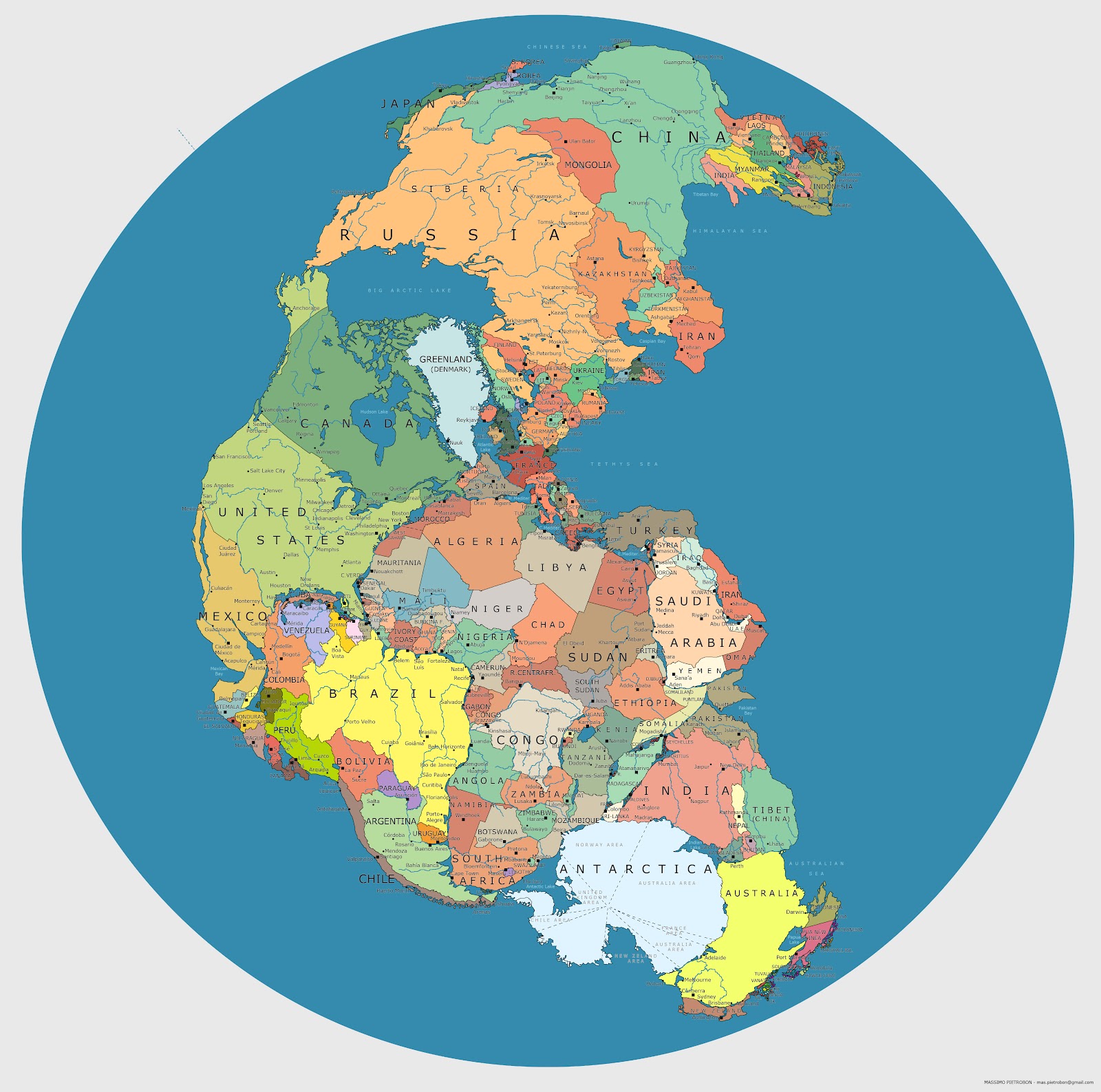
Political map of Pangaea (2012)
Explore Massimo Pietrobon's map, which compares the position of the continents 335 million years ago with the political map of the 21st century.

Artisanal and ancestral beverages of Colombia (2024)
This infographic was created in 2024 by Soranny Moncada Franco, Brian Castaño and Victor Mosquera, in collaboration with Proyecto Brujeria...

The known world (Game of Thrones)
This map was created by cartographer Jonathan Roberts as part of his collaboration on the book The Lands of Ice...

Major rivers and mountains of the world (1864)
This illustration was published by Schönberg and Co. in 1864, in the book Standard Atlas of the World. It is...

Literary Map of Latin America (1988)
This map, drawn by Mike Cressy, was published by Aaron Blake Publishers in 1988. The work takes a journey through...

The World of One Piece (2025)
This map, drawn by Justine Vignat in 2025, shows the world of One Piece, with information available in the manga and...

The Coral Triangle (2011)
This map, published by WWF International in 2011, serves as an educational resource on the Coral Triangle, the marine region…

The historic counties of the United Kingdom (2011)
This map, drawn by Michael Garber, was published by the Association of British Counties (ABC) in 2011. The ABC is…

Canada’s Mythological Monsters (2023)
This map, created by Neil Parkinson of Púca Printhouse in 2023, shows the monsters of Canadian mythology. Among…
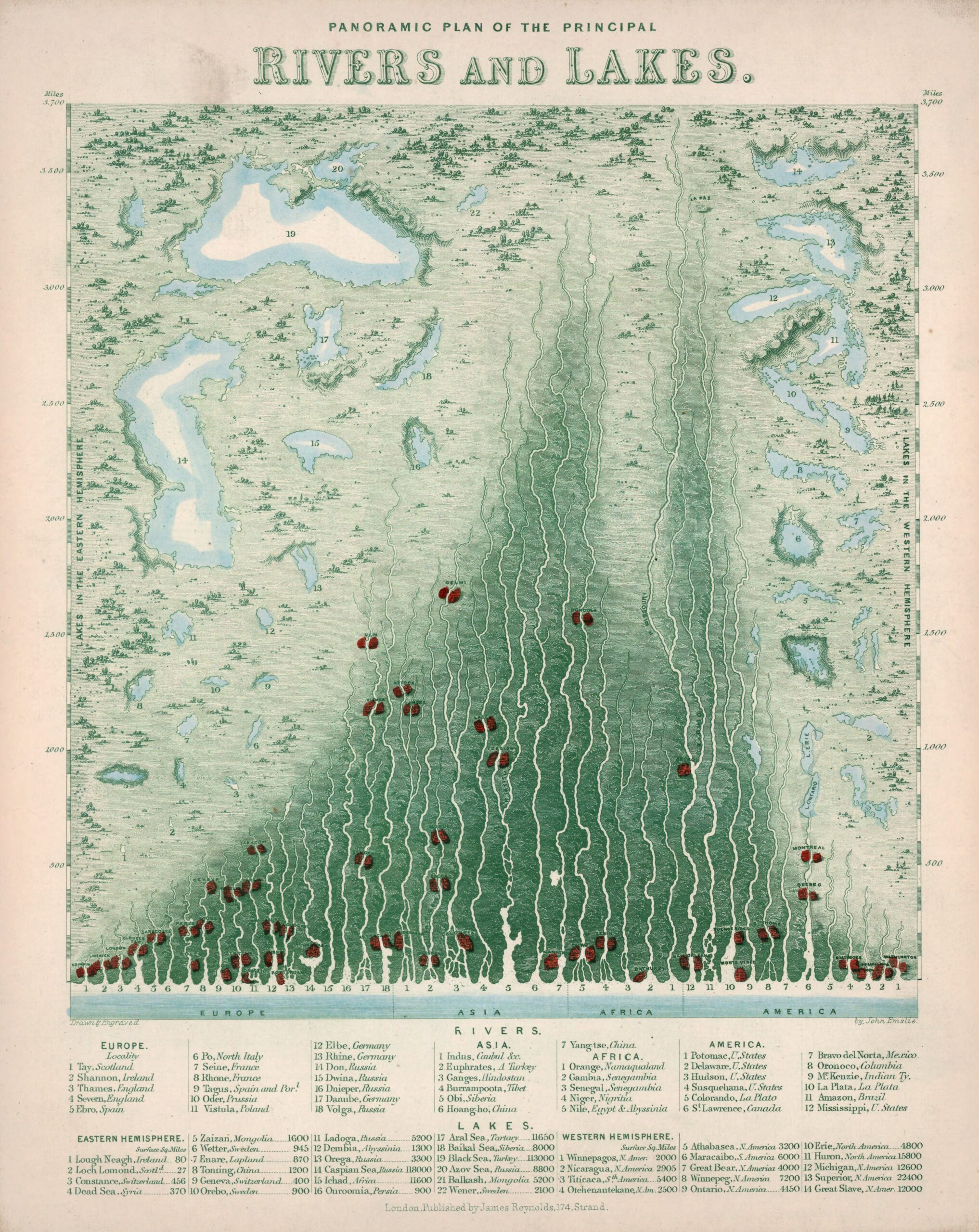
Panoramic map of the main rivers and lakes (1850)
This work, drawn by British cartographer John Emslie and published by James Reynolds in 1850, forms part of a...

Voronoi's Spain
This map divides Spain into Voronoi regions, which assign each provincial capital the geometrically closest territory.

Peru, in the style of World of Warcraft (2024)
This map, created by Santiago Reyes in 2024, depicts Peru. The illustration is part of a project to depict all of Latin America...

Ecuador, in the style of World of Warcraft (2023)
This map, created by Santiago Reyes in 2023, depicts Ecuador. The illustration is part of a project to depict all of Latin America...
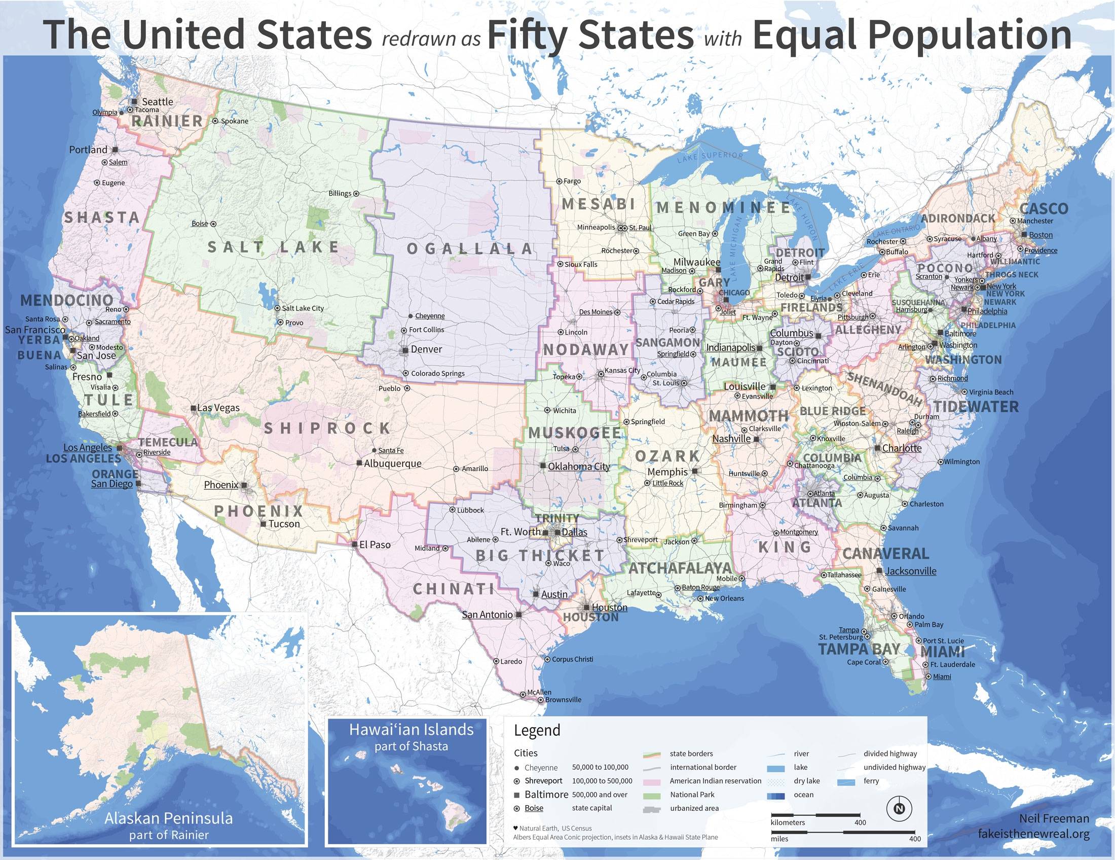
The United States with an equal population (2012)
This map was created in 2012 by Neil Freeman to illustrate a possible electoral reform in the United States to provide...

The true size of Peru (2022)
This map, created by Ruy Pinto Schaffroth, shows the comparative size of Peru and several European countries. Peru, with 1.28...

South America on a cushion for the blind (1900)
This piece was possibly created by students at the Perkins School in Massachusetts, USA, around 1900. It shows...

Antarctica, World of Warcraft-style (2023)
This map, created by Santiago Reyes in 2024, depicts Antarctica. The illustration is part of the project to represent the entire...

Europe according to the British (2010)
This map, created by Yanko Tsvetkov, can be found in the first volume of the Atlas of Prejudice...
 Español
 English (UK)