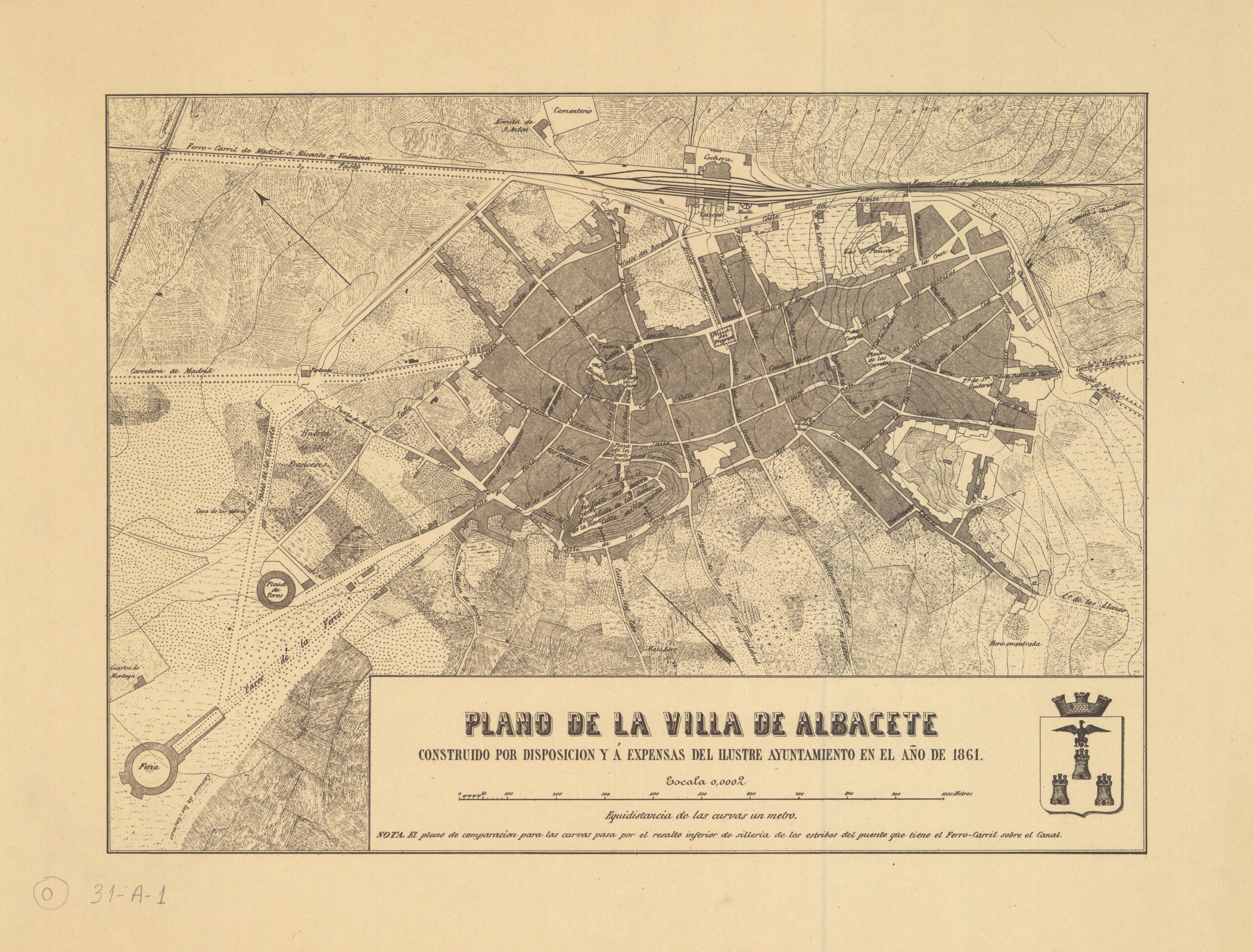
This plan was commissioned and financed by Albacete City Council in 1861, although the name of the author is not recorded. This particular copy is a reproduction published by the City Council in 1980.
The city had obtained the provincial capital status in 1833. The railway also reached the city in 1855, as a stop on the line linking Alcázar de San Juan and Cartagena. Just one year after the publication of this map, in 1862, Queen Isabella II granted Albacete the title of city, making this map the last one to show Albacete as a town.
The plan, oriented to the northeast at the top, shows a city that had already suffered the ecclesiastical and civil confiscations. The main convents in the town had already changed hands and changed use, such as the Justinian monastery to the Treasury Office, or the Augustinian monastery to the Territorial Court. What had not yet been transformed was the urban layout, the reorganisation of which would take decades to materialise.
The only substantial change in this map from plans of previous centuries is the railway station at the top, which was already encouraging the creation of new streets and buildings in the north-east of the city, in the vicinity of the station.
Sources

