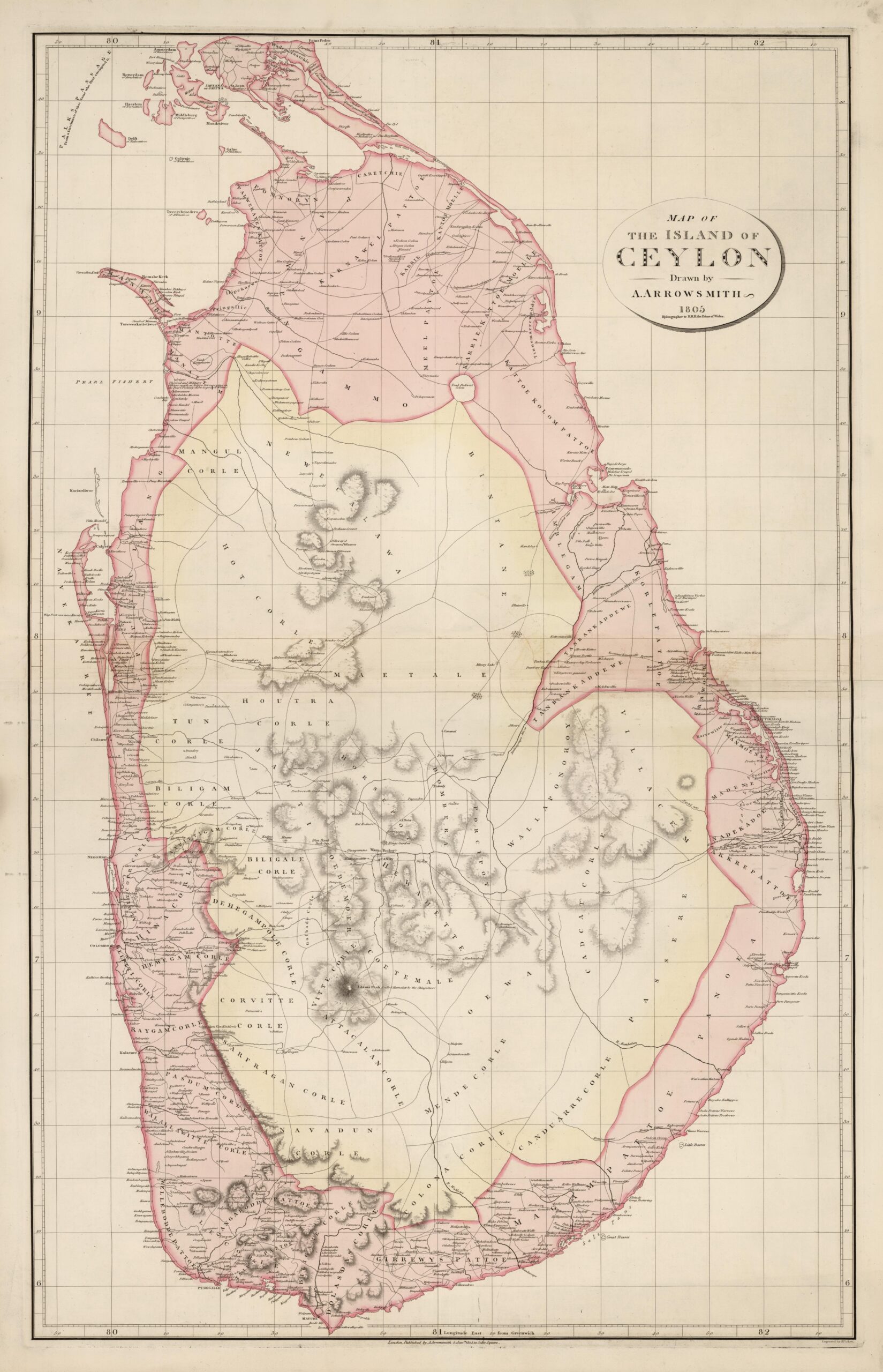
This map of the island of Ceylon, mapped by Aaron Arrowsmith, was published in London in 1805. It is a loose map of which only two known original copies survive, in the Bodleian Library, Oxford, and in the British Library.
The island of Ceylon, now Sri Lanka, had been under Dutch control until 1795. After the fall of the Dutch under Napoleonic control, the Dutch authorities ceded their possessions in Ceylon to the British Empire to prevent them from also coming under French control, which was later ratified in the Treaty of Amiens in 1802.
In this map, Arrowsmith shows Ceylon divided into two main parts. Along the entire coast, in pink, are the territories controlled in 1805 by the British Empire. The interior of the island, in yellow, groups together the territory that remained under the Kingdom of Kandy. This kingdom had coexisted with the European colonial presence for two centuries without ever losing control of the island's interior. In 1803, two years before the publication of this map, the British Empire had been militarily defeated by Kandyan troops in its attempt to control all of Ceylon.
The island would not fall completely into British hands until 1815, when the Kandyan king was overthrown by the British with the help of an opposing faction, completing the incorporation of the territory of the Kingdom of Kandy into the Empire.
Sources

