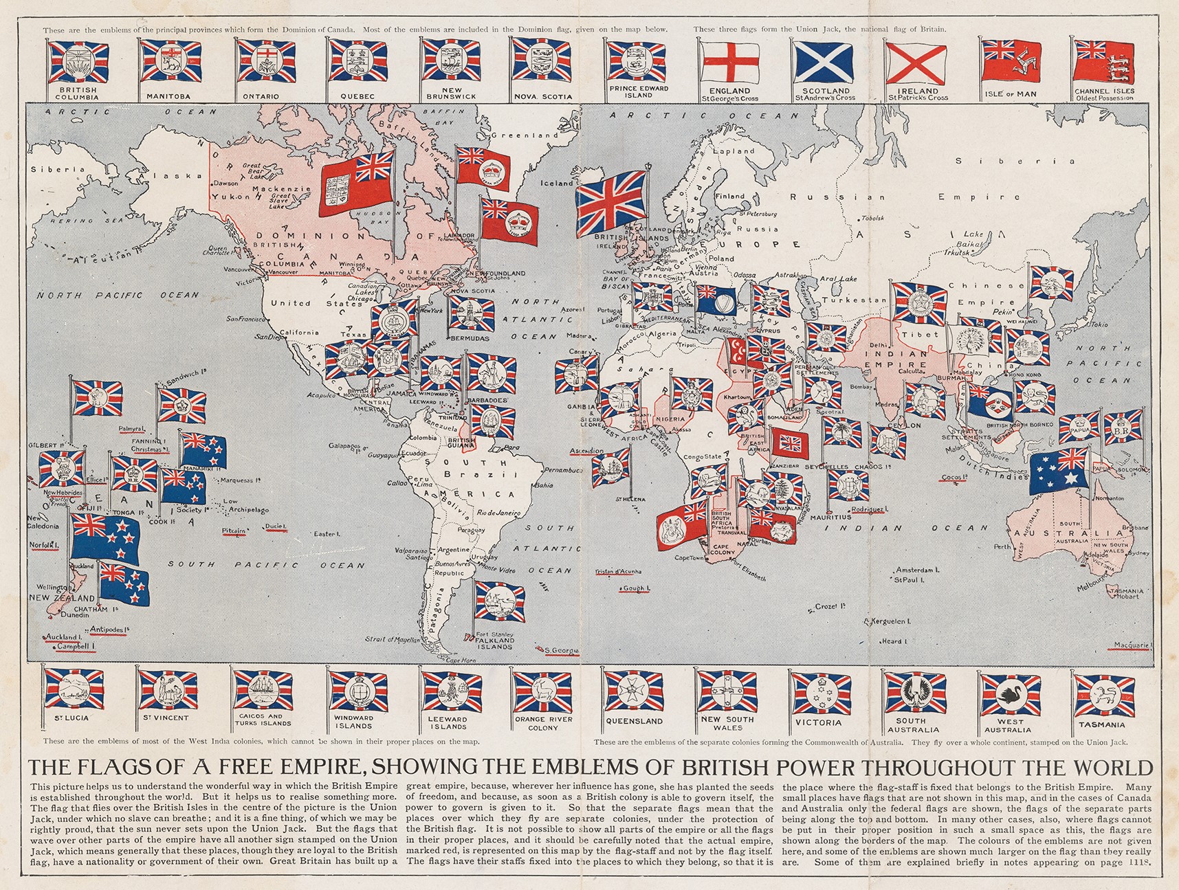
This map was published in 1910 by the British Arthur Mee, as part of his encyclopaedia for children, The Children's Encyclopaedia. The map shows all the possessions of the British Empire, accompanied by the emblems of each of the possessions around the world.
The use of the flags and emblems of the colonies, in addition to being illustrative, also served as a way to occupy much more space than the British Empire's possessions actually occupied. In this way, when children looked at the map, they perceived British possessions to be much greater in power and influence than they actually were.
In addition to the flags of each of the colonies, another series of flags appear at the top and bottom of the map to detail each of the administrative regions of Canada, the British Isles and Australia. This is also the case for some islands that could not be represented due to the high density of possessions in the area, such as Saint Lucia and Saint Vincent.
The title of the map itself has a propagandistic intent, referring to the British Empire as a free empire. This is in line with other maps of the time that sought to clean up the colonialist image of the empire, as is the case with the Walter Crane's map from 1886.
Sources
- Arthur Mees Flags of a Free Empire 1910 Cornell
- The Flags of a Free Empire, Showing the Emblems of British Power Throughout the World


 Español
  English (UK)