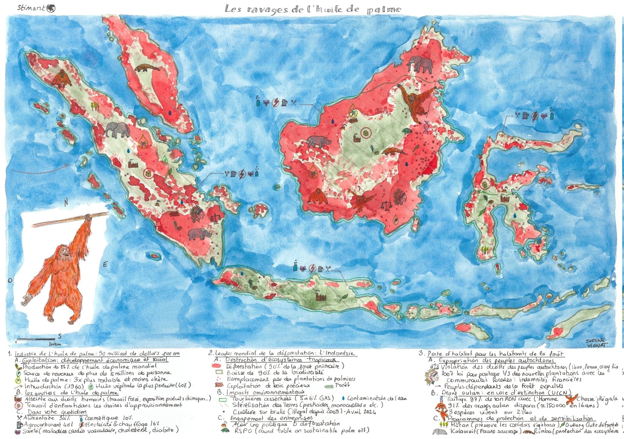
This map was published by Justine Vignat in 2024 as part of the initiative #30DayMapChallenge.
The map, painted in watercolour, depicts the Indonesian archipelago and the Malay Peninsula. The areas affected by deforestation and the expansion of palm plantations are marked in bright red, while the regions where the rainforest is still preserved are marked in green. The balance between the two colours makes the problem clear: Indonesia and Malaysia together produce 85 % of the world's palm oil. It is precisely in these countries that these plantations have had the greatest impact on tropical ecosystems.
In the legend, the information is structured in three main thematic blocks that provide more information on the economics behind the industry, the environmental impact of deforestation and the impact on human and animal habitats, with a special focus on the orangutan.
You can find more information about the initiative here. #30DayMapChallenge in what I wrote in the newsletter.
Sources

