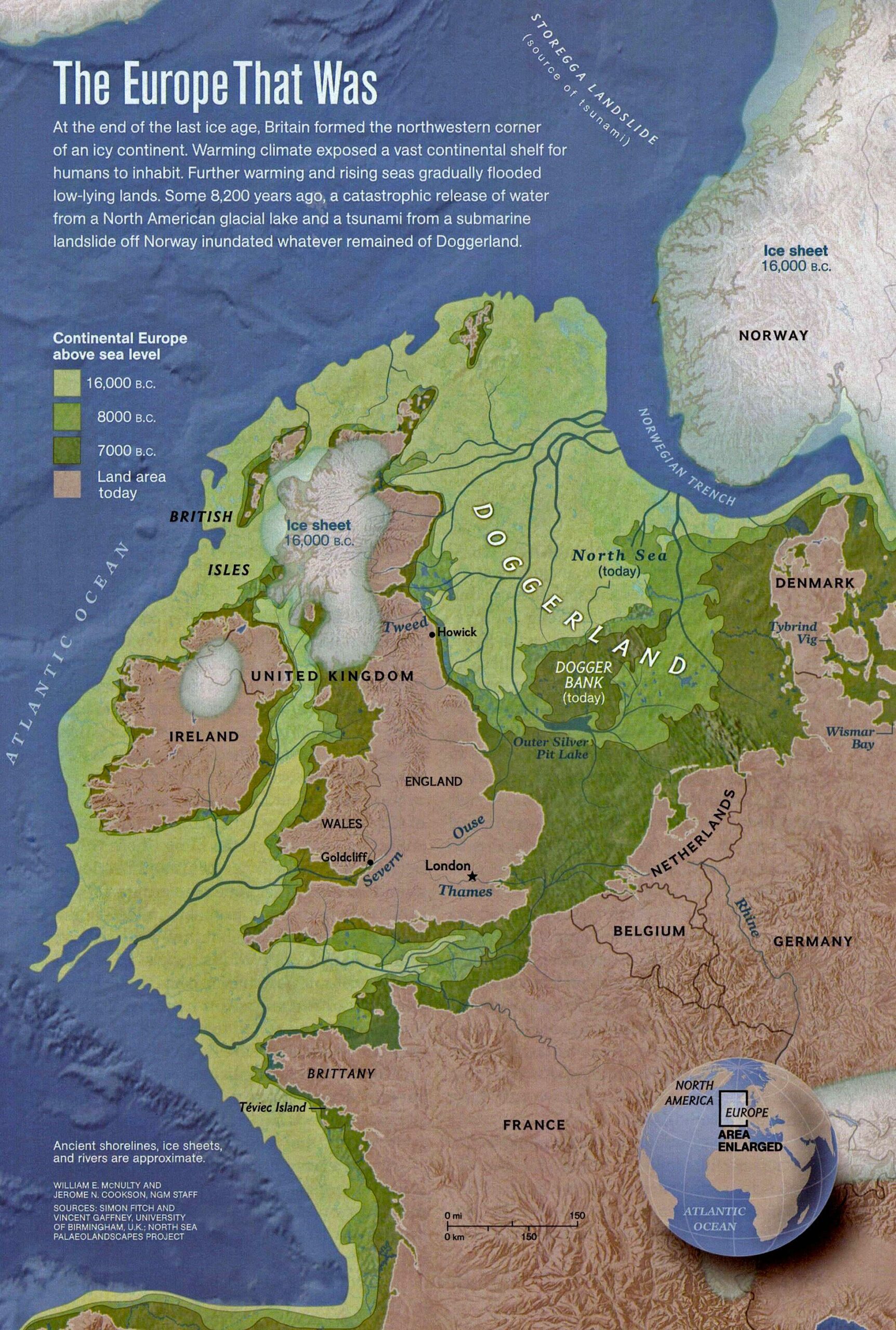
This map, drawn by William E. McNulty and Jerome N. Cookson and published by National Geographic in 2012, shows the former emerged lands of Doggerland. The map is based on scientific data collected by the North Sea Palaeolandscape Research Team at the University of Birmingham.
Doggerland is the name given to the land that emerged in the North Sea during the last Ice Age, when the sea level was more than 100 metres below its present level. The map, in light green, shows the maximum extent of this territory in 16,000 BC, when the world's glaciers accumulated the greatest volume of water. Medium green shows the extent of the coasts in 8,000 BC, and dark green in 7,000 BC, as the melting of ice caused the coasts to recede to their current extent.
Doggerland connected the British Isles with the rest of mainland Europe, which facilitated the arrival of humans in Britain. Archaeological remains also confirm that humans populated this land during this period.
The map also shows the complex river system that ran through Doggerland. The Thames, Rhine and Seine were tributaries of a great river that flowed through what is now the English Channel and into the Atlantic Ocean.
Here you can read more about lands emerged during the last glacial peak.
Sources

