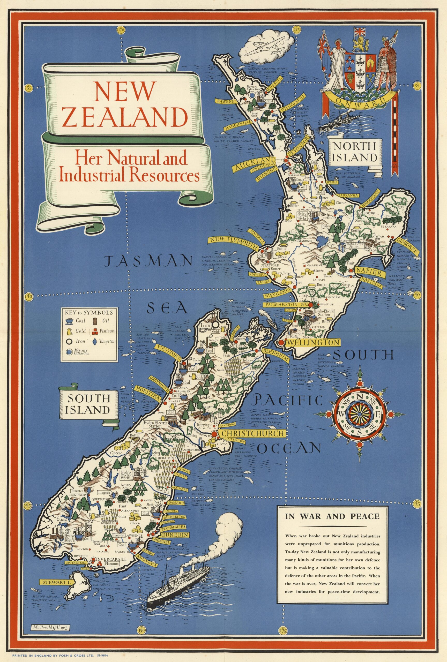
This map, by Leslie MacDonald Gill, was commissioned by the UK Ministry of Information and published in 1943 in the context of the Second World War.
With an appearance similar to other pictorial maps The map shows New Zealand, focusing on its natural resources and its agricultural and industrial production. The legend at the top left shows the seven most important resources that can be found on the map (though not the only ones): coal, oil, gold, platinum, platinum, iron, tungsten and mercury.
The choice of the elements of the legend over others is not accidental. It focuses on scarce resources of great wealth or industrial potential. This is complemented by the text on the lower right, which details New Zealand's importance to the United Kingdom and its commitment to the Allies in World War II, not only by manufacturing munitions for defence, but for the defence of other regions of the Pacific Ocean.
The purpose of this map is purely propagandistic, albeit disguised as neutrality. The British Information Services distributed this map and others like it in New York, with American society as a priority. The aim of this campaign was to convince the American allies that the Commonwealth had resources and industry to support the war despite the UK's difficulties on the European front.
Sources

