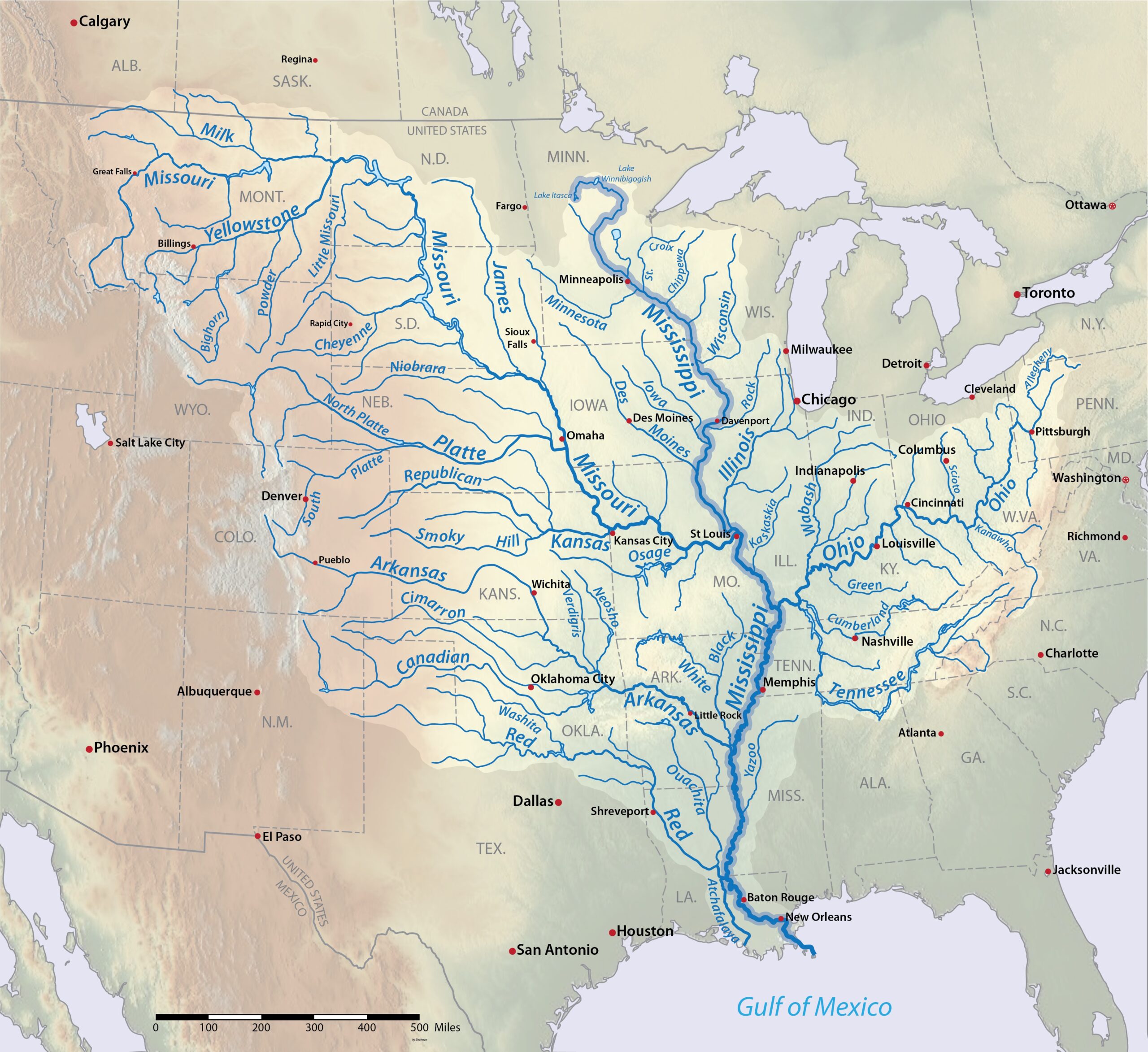
This map, created by Shannon1 for Wikimedia Commons in 2016, shows the course of the Mississippi River, its watershed and its main tributaries, including the Missouri and Ohio.
The Mississippi River rises in Lake Itasca, in the state of Minnesota, and flows 3,770 kilometres south to the Gulf of Mexico. Its watershed is 3,238,000 square kilometres, which is almost a third of the territory of the United States and part of 31 of its states. This makes it the largest river basin in North America and the fourth largest in the world. Among its tributaries, the Missouri deserves special mention, since at 4,370 kilometres long it is longer than the main river itself.
Sources

