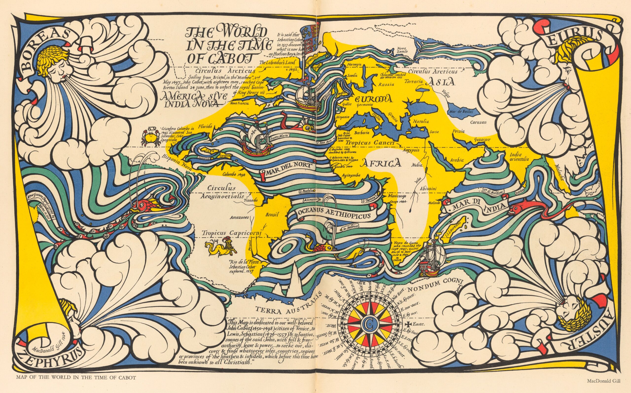
This map was published by Leslie MacDonald Gill in 1924, as part of a book accompanying Pageant of Empire, a series of celebrations of the history of the British Empire held at Wembley that same year.
The illustration commemorates the voyage in which John Cabot (Juan Caboto), a Venetian explorer, and his three sons, Sebastian, Luigi and Santo, sailed along the coast of North America in 1497 aboard the ship. Matthew as part of a commission funded by Henry VII, King of England. The mission had the authority to discover any pagan country or island for the interests of England. Interestingly, when Cabot arrived in Newfoundland, he thought he had actually arrived in Japan.
The map indirectly compares this voyage to that of Christopher Columbus, as it is the only other ship and event marked on the map. Similarly, the map extols the possessions of the British Empire at the beginning of the 20th century, such as the island of Saint Helena, in the middle of the South Atlantic, which was not discovered until 1502.
Sources

