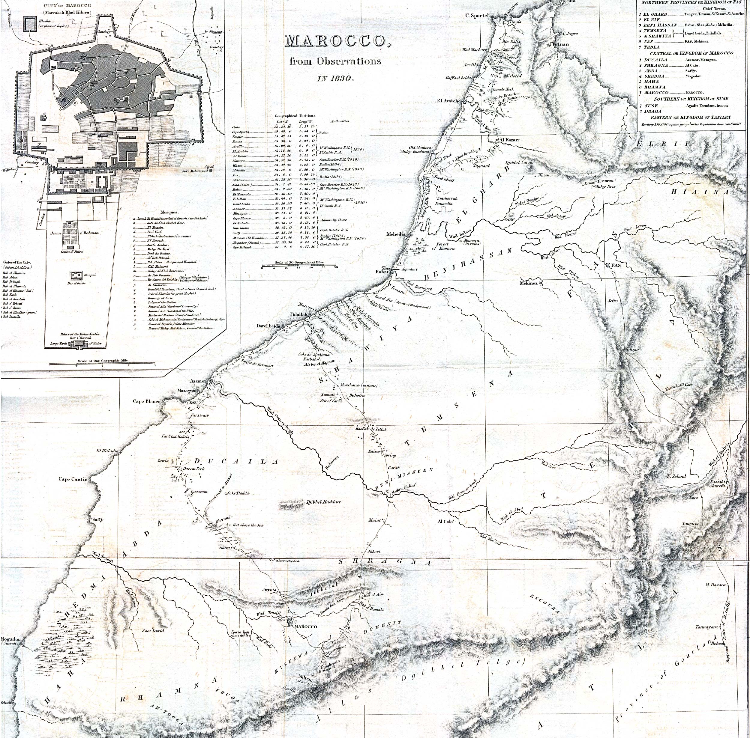
This map of Morocco was published by John Murray in 1831 for the Journal of the Royal Geographical Society of London, with observations obtained throughout the year 1830.
The map covers the entire Sultanate of Morocco, although it divides it into four kingdoms (in the upper right-hand corner):
- Kingdom of Fez or northern provinces.
- Kingdom of Morocco or centre.
- Kingdom of Sus or South.
- Kingdom of Tafilalet or East.
The map also includes a plan of the city of Marrakesh, capital of the sultanate, in the upper left-hand corner.
Sources
- Perry-Castañeda Library Map Collection – Morocco Maps
- Morocco, from observations in 1830 – Princeton University

