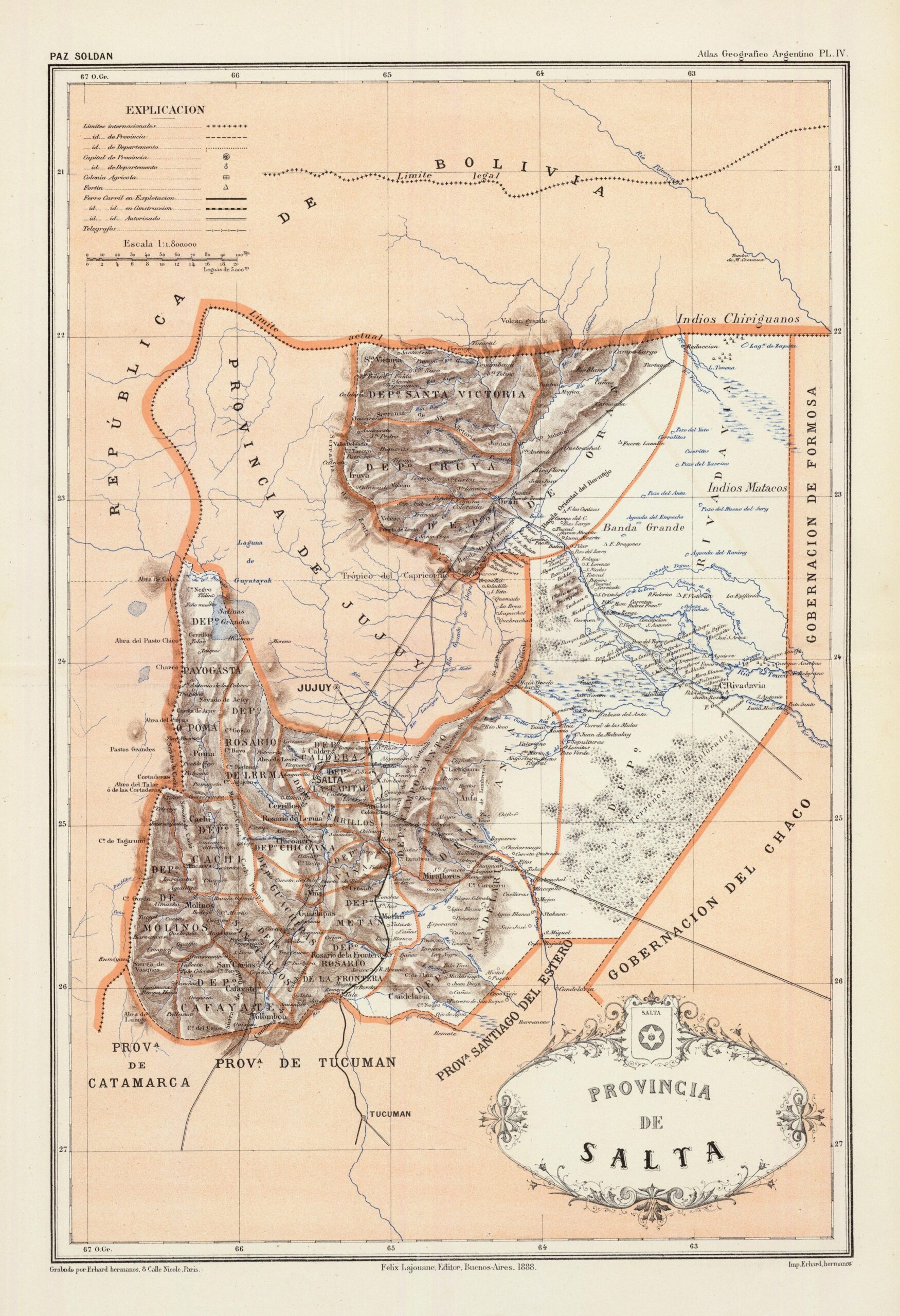
This map of the province of Salta, drawn by the cartographer Mariano Felipe Paz Soldán, was published in 1888 as part of the Geographical atlas of the Argentine Republic.
The map shows the province of Salta with its constituent departments, the hydrographic network and the main localities at the end of the 19th century. The northern boundary with Bolivia shows two distinct lines. The boundary that Argentina considered legitimate (legal boundary) and the de facto boundary of the province of Salta at the time (current boundary). This distinction is the result of the dispute over the department of Tarija, which had been part of the Salta del Tucumán Intendancy since 1807, but which Bolivia had controlled since 1826. This dispute was not definitively settled until the signing of the 1889 treaty.
Sources

