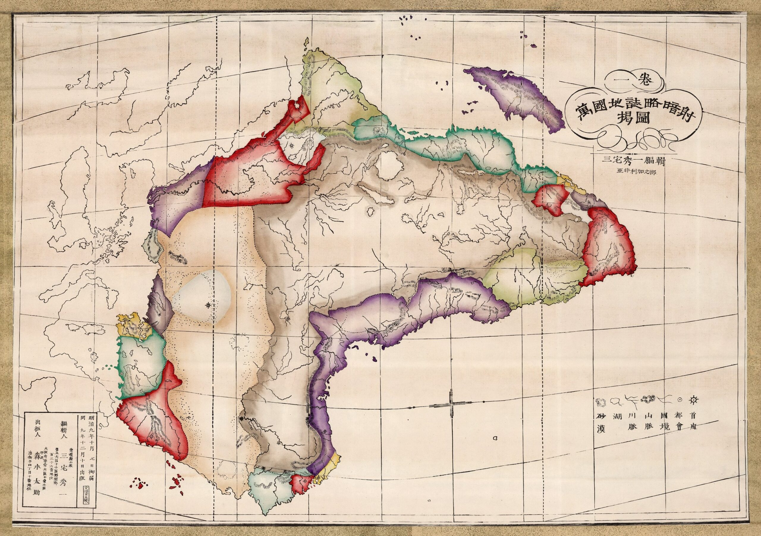
This map, created by cartographer Shūichi Miyake in 1876, was one of the maps used in Japanese schools during the Meiji era to study the geography of territories beyond Japan.
The author depicted Africa, with its coasts, lakes, and rivers outlined in black. The most striking feature is its orientation, with the east at the top of the map. The use of colours to represent the main regions of the continent is also eye-catching:
- Cape Town, in red.
- East Africa, in green.
- The Horn of Africa, in yellow.
- Sudan, in red.
- Egypt, in purple.
- Libya, in brown.
- Tunisia, in yellow.
- Algeria, in green.
- Morocco, in red.
- Senegal, in green.
- West Africa, in purple.
- Angola, in yellow.
At this time, prior to the Berlin Conference of 1884–1885, the division of the African continent among the European colonial powers was still ambiguous, but on this Japanese map, the colours do not even attempt to show this European presence. The map also includes the main cities marked with circles and suns, such as Cairo, Oran, Casablanca, Tunis, Addis Ababa and Cape Town.
You can read more about maps, education, and propaganda in Japan at this article in the newsletter.
Sources

