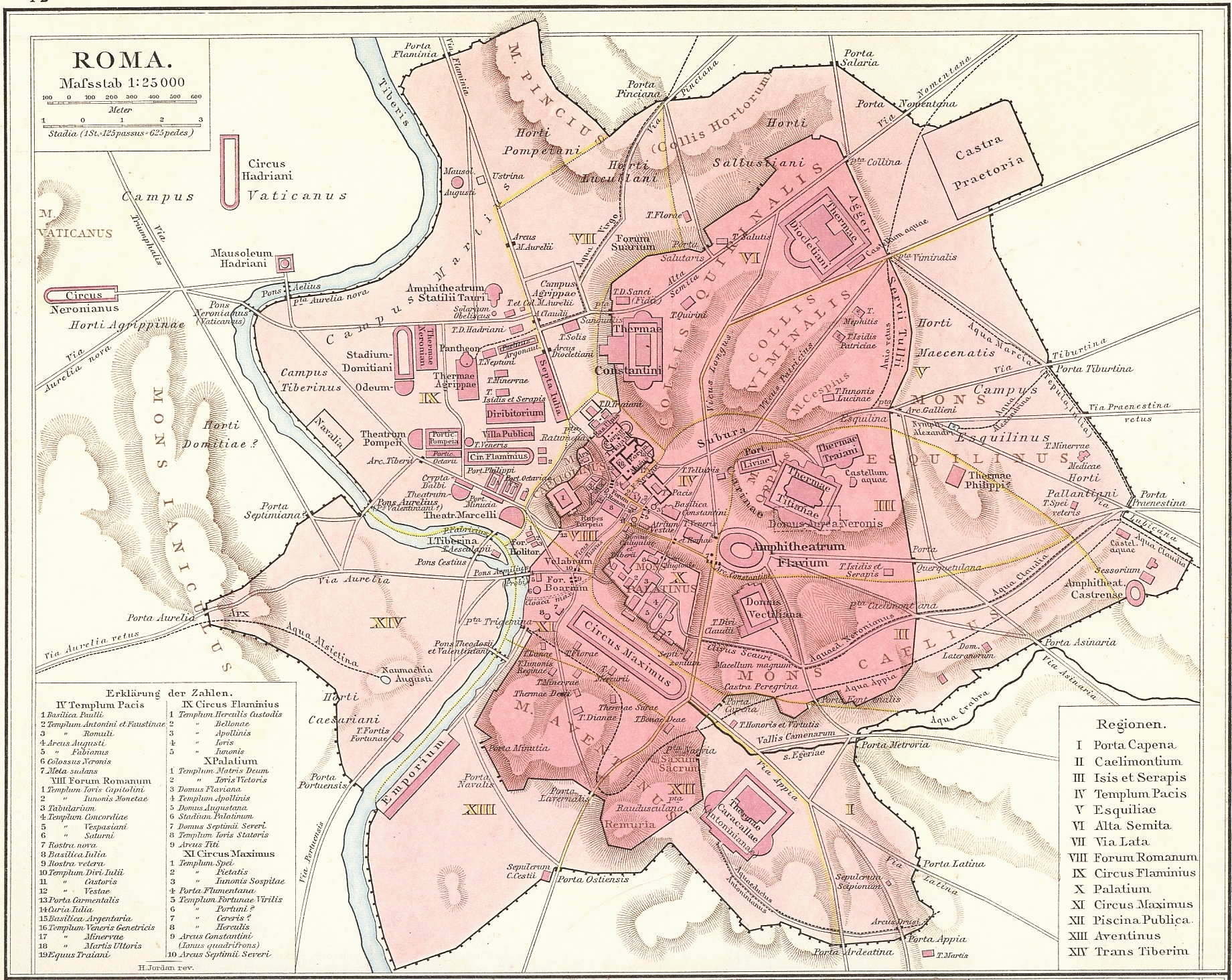
This map of ancient Rome, created under the direction of German geographer Richard Andree, appears in the historical atlas published by German historian Gustav Droysen under the name General Historical Atlas in 1886.
The map depicts the entire city of Rome during its time as the capital of the Roman Empire. The colours show the two areas protected by the two most important walls in Roman history:
- Servian walls, in dark pink. Although named after Servius Tullius, the sixth king of Rome, according to tradition, their construction appears to date back to the 4th century BC rather than the 6th century BC. They remained in use until the 3rd century AD.
- Aurelian Walls, in light pink. They were built under Emperor Aurelian in the 3rd century AD. At the time of their construction, they were 19.5 kilometres long, of which 12 kilometres remain today.
In addition, the map also refers to the 14 regions into which Emperor Augustus divided the administration of the city of Rome, which are numbered from I to XIV. Similarly, the seven hills that historically constitute the heart of Rome are marked:
- The Aventine Hill (M. Aventinus)
- The Capitol (M. Capitolinus)
- El Celio (Caelian Hill)
- El Esquilino (Mount Esquiline)
- The Palatine Hill (Palatine Hill)
- The Quirinal (Quirinal Hill)
- The Viminal (Viminal Hill)
Sources

