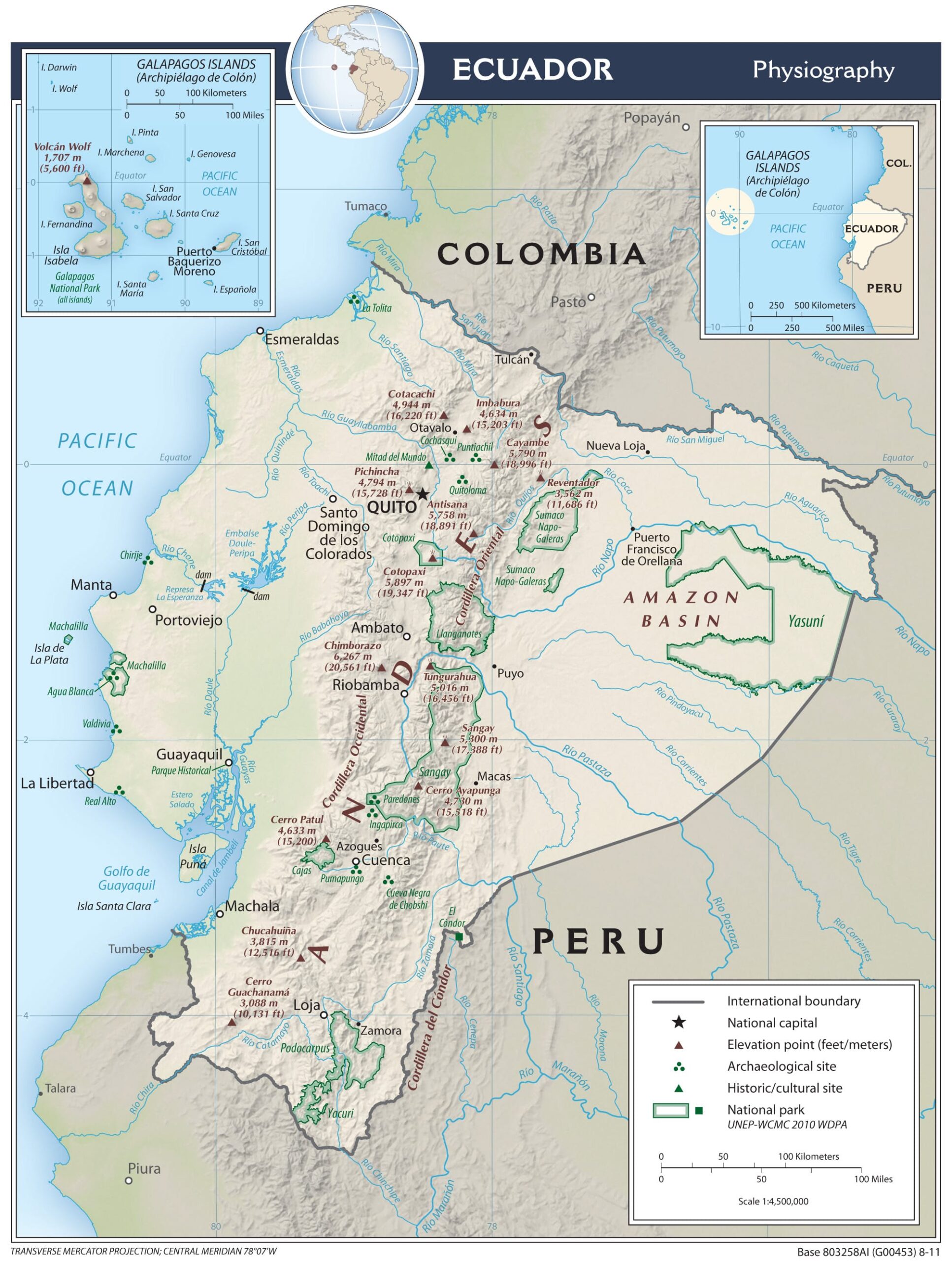
This physical map of Ecuador was published by the CIA in 2011.
The map has a colour base that determines the relief of the different regions. On top of this, it incorporates rivers and lakes in blue, as well as the main peaks (brown triangles) and cities (white dots). It also incorporates national parks (marked in green), the main archaeological sites (three green dots) and UNESCO World Heritage Sites (green triangles).
Sources

