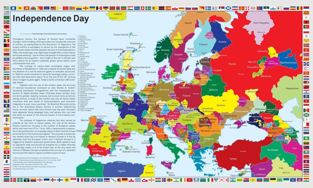
This map was published in 2014 and shows all the nationalist and independence movements in Europe. It was created by The Department, an agency founded by Theo Deutinger that combines research, architecture and data visualisation, from urban to global scale.
The aim of the map is to show the situation that could arise if all independence and nationalist movements achieved their political goals. All these movements are shown on the map of Europe and are also represented by their respective flags in the outer frame.
The illustration takes nationalism to extremes, as it presents some independence movements with years of strong activism, such as Catalonia, Scotland, and Sardinia, but also includes some cases that lack weight or significant popular support.
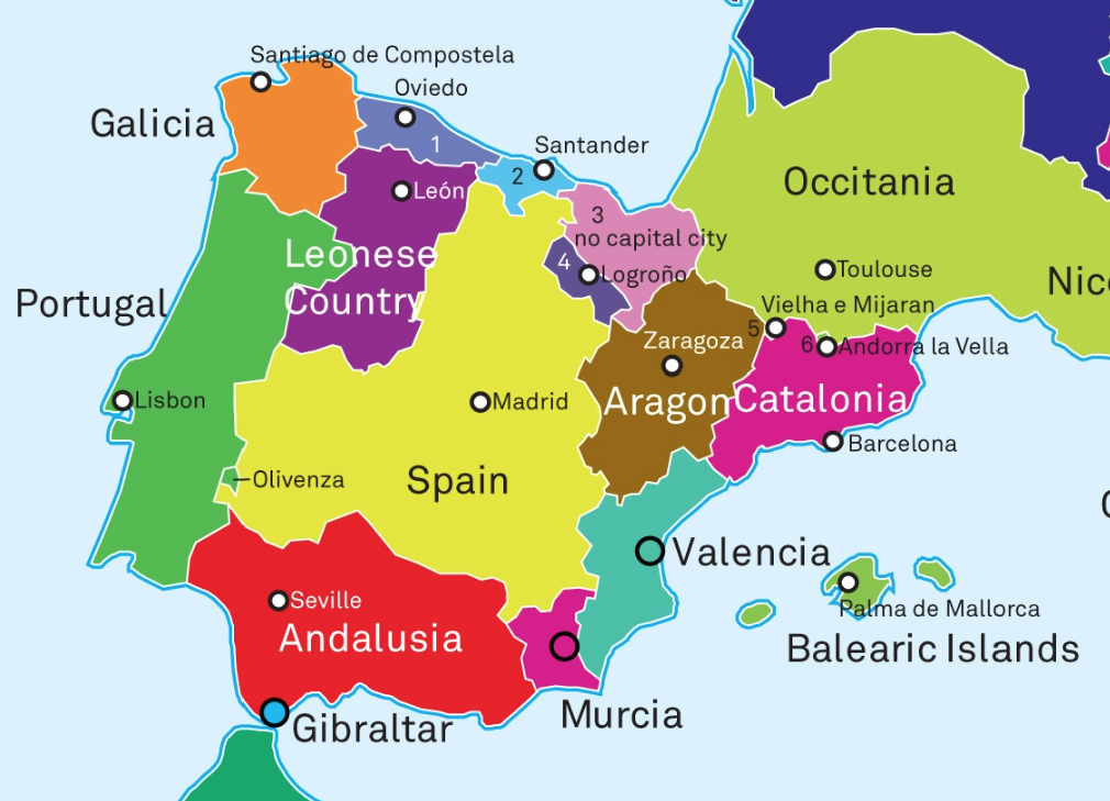
In the specific case of the Iberian Peninsula, the following list of nationalisms and independence movements is shown: Galicia, Asturias, Cantabria, Basque Country, León, Spain, Logroño, Aragon, Aran Valley, Catalonia, Valencia, Balearic Islands, Murcia, Gibraltar, Andalusia, Olivenza and Portugal. Details are provided below.
The map was revised in 2019 to add even more nationalist, separatist and independence movements.
Sources
- Independence Day – The Department
- Independence Day 2019 – The Department
- Independence Day – Vivid Maps

