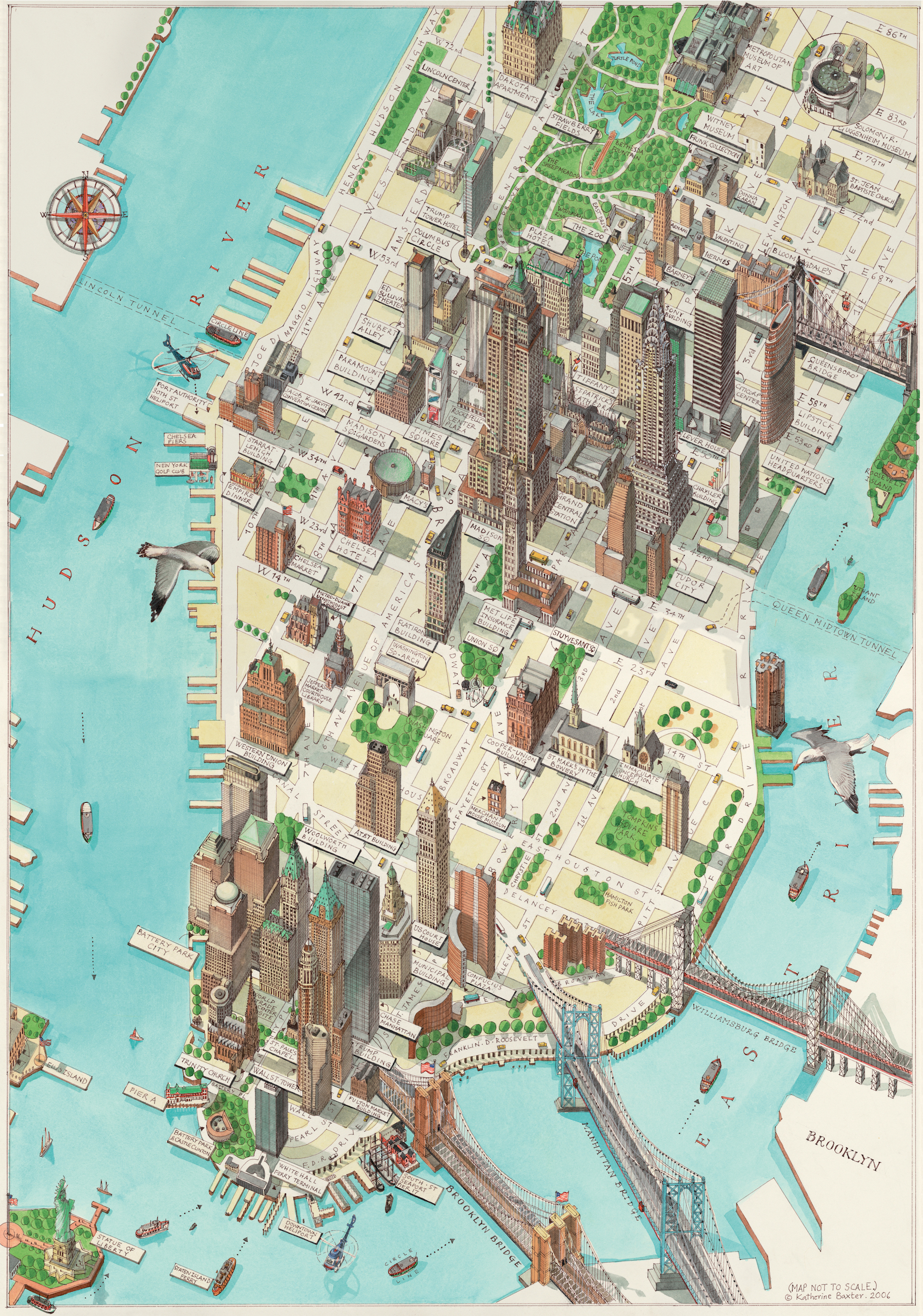
This map was created in 2006 by Katherine Baxter for the British newspaper The Times. The painting, done in watercolour and pen, focuses on the southern part of Manhattan Island.
The map, which is not to scale, only shows the most important avenues and streets in this part of the city. At the same time, it shows the most famous buildings and monuments, as well as docks and bridges, in an oversized manner.
Sources

