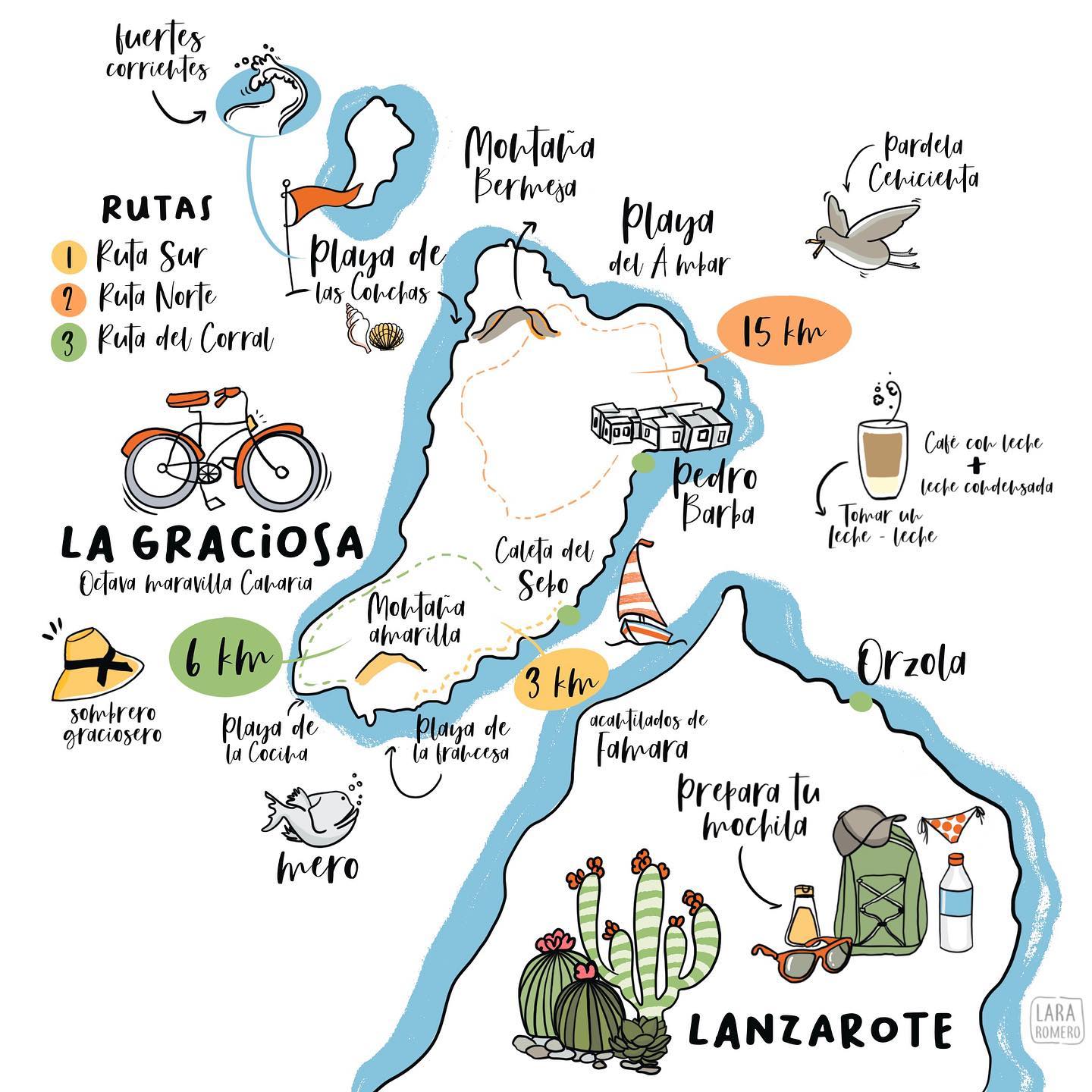
This illustrated map, published by Lara Romero In 2021, it shows the island of La Graciosa, in the Canary Islands, north of Lanzarote.
The map features the island’s most distinctive landmarks: its two main settlements, Caleta de Sebo and Pedro Barba; the volcanic cones of Montaña Bermeja to the north and Montaña Amarilla to the south; beaches such as Las Conchas, with its strong currents, La Cocina, La Francesa and El Ámbar; and the three routes that criss-cross the island: the Southern Route (3 km), the Northern Route (15 km) and the Corral Route (6 km).
At the bottom is the north of Lanzarote, separated from La Graciosa by the Strait of El Río, barely one kilometre wide, featuring Órzola – the port from which boats set sail for La Graciosa – and the cliffs of Famara. The map also features the Cory’s shearwater, the grouper, the «sombrero graciosero», ‘leche leche’ (coffee with milk and condensed milk), a bicycle alluding to an island with no tarmac roads, and the subtitle ‘Eighth Wonder of the Canary Islands’, a reference to its recognition as the eighth inhabited island of the archipelago in 2018.
Sources


 Español
  English (UK)