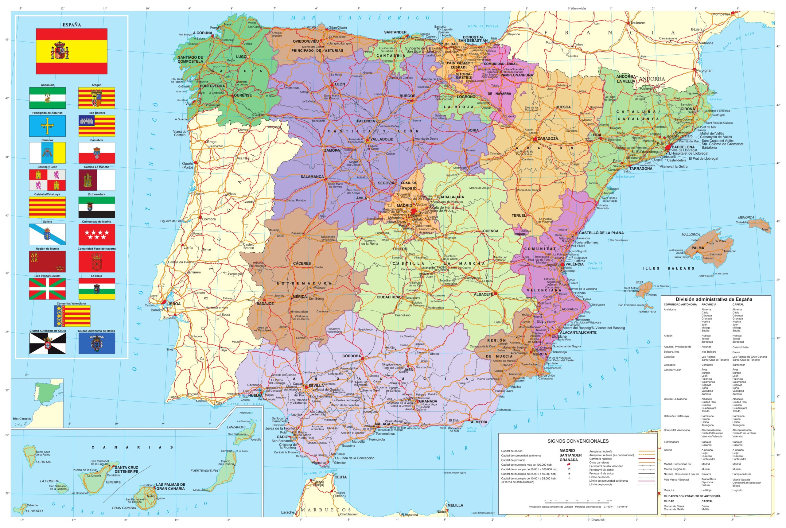
This map, published as part of the National Atlas of Spain in 2023, shows the territorial administration of Spain.
The map represents the territorial organisation of Spain, with its administrative scales at two levels. The 17 autonomous communities and the two autonomous cities, Melilla and Ceuta, are shown in different colours. Grey lines show the 50 provinces into which the Spanish autonomous regions are divided.
Also shown in red are all the municipalities in Spain with more than 100,000 inhabitants, as well as a detailed description of the country's road network: motorways and dual carriageways in yellow with a red border; national roads in red; and regional roads in orange. The railway network is represented by black lines, slightly wider, and with black ‘x’ on the route the AVE (Alta Velocidad Española) lines are shown.
The Canary Islands are shown in a box at the bottom left, closer to Spain than they are in reality, following the usual convention of Spanish cartography.
Sources

