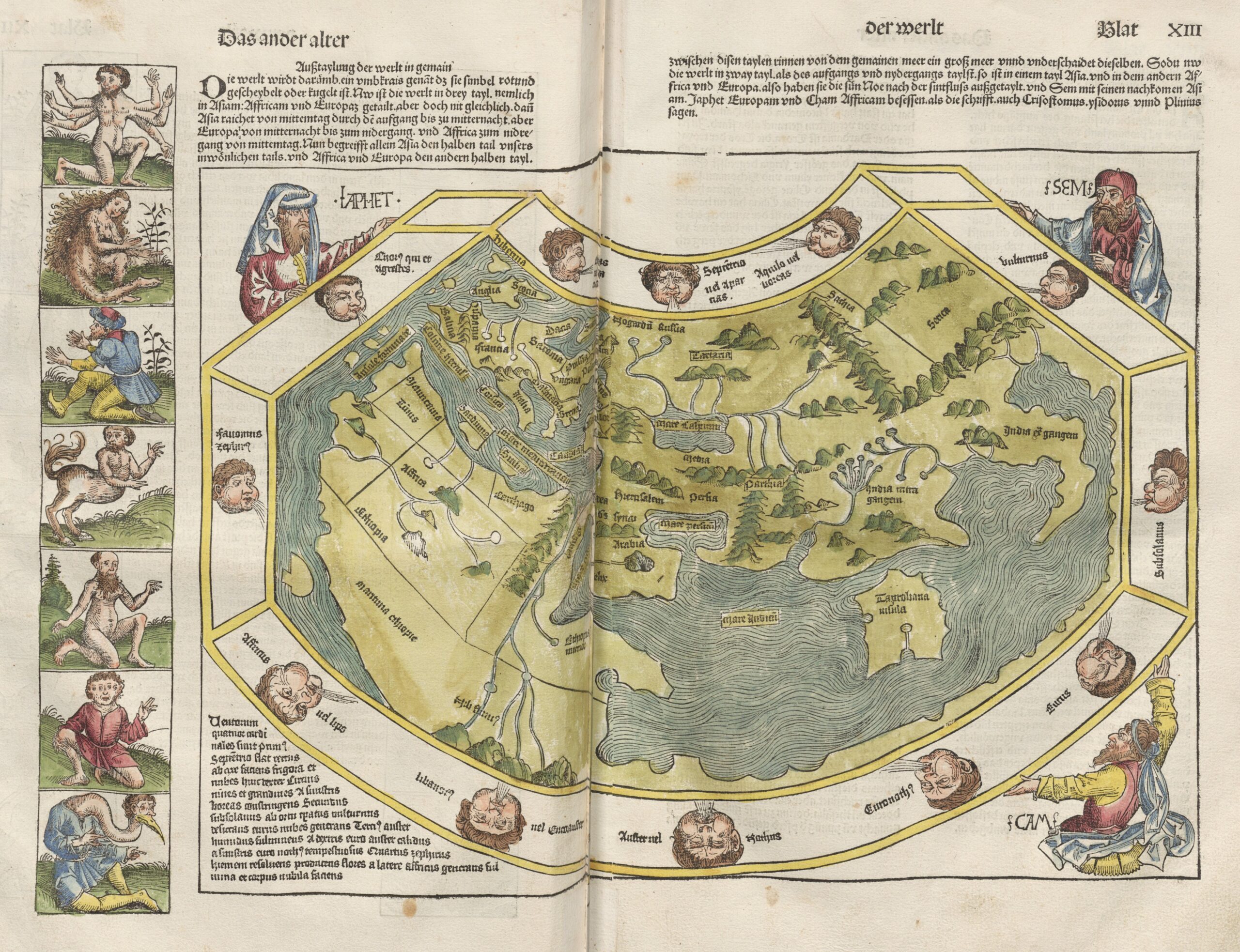
This map was published in 1493, within the Liber Chronicarum, the work popularly known as the Nuremberg Chronicles. The book was Hartmann Schedel's masterpiece, with Michael Wolgemut and Wilhelm Pleydenwurff as illustrators.
This particular map is part of the second section of the book, devoted to the description of the known world. Follow the Ptolemaic tradition, showing Europe in the upper left, Africa in the lower left and Asia in the upper right. Outside the frame framing the map are Shem, Ham and Japheth, the sons of Noah who, according to Christian tradition, divided up the world. A gallery of fantastic creatures typical of classical geography also appears on the left.
The Nuremberg Chronicles were published only a few months after Christopher Columbus arrived in America, and before knowledge of the new continent spread throughout Europe. This makes this world map one of the last that does not show America.
You can consult the article dedicated to the Nuremberg Chronicles in the newsletter for more details on this incunabulum.
Sources

