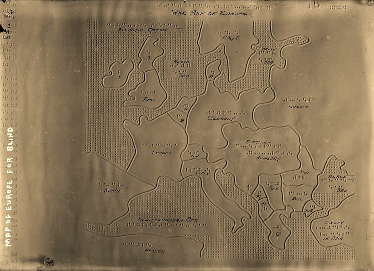
There is little information available about this map. Based on the details it shows about the war in Europe and the existing borders, it can be inferred that it was published at the beginning of the First World War, possibly around 1915.
The unique feature of this map is that it is designed for blind people, with all labels written in Braille. In addition, the map is covered with reliefs, with dots to identify areas covered by seas and oceans, as well as lines to determine coastlines and borders between different countries.
The map corresponds to the photographic collection of Bain News Service, founded by George Grantham Bain, which is available in its entirety on the website of the Library of Congress of the United States.
In the newsletter, I have written more about maps for the blind and their history. You can read it here:
- The origins of cartography for the blind
- Braille, Kunz and modern cartography for the blind
- The present and future of cartography for the blind
Sources

