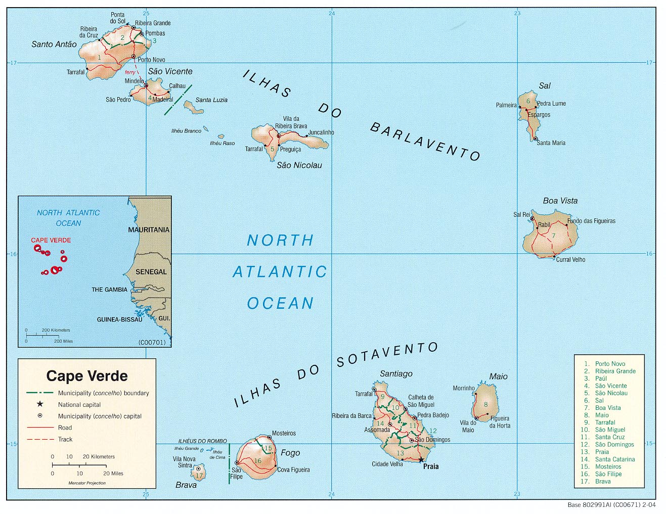
This map of Cape Verde was published by the CIA in 2004 and is currently held in the cartographic collection at the Perry-Castañeda Library (PCL) at the University of Texas at Austin, United States.
The map shows the different municipalities of Cape Verde, represented in green; roads, in red; and paths, in dotted red. The administration changed in 2005 and the number of municipalities increased to 22.
Sources

