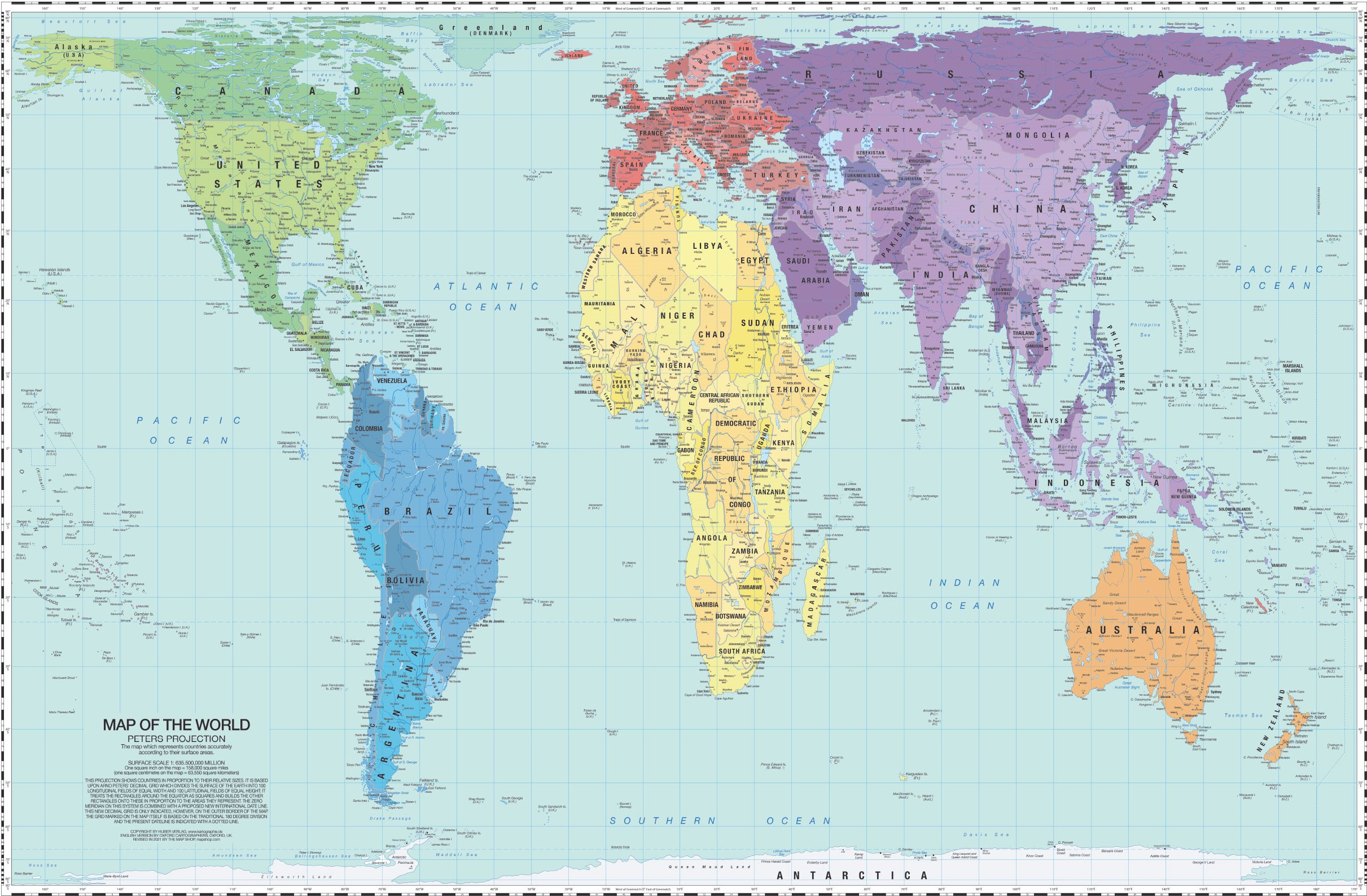
Gall-Peters projection map with political boundaries for 2021.
This projection was originally conceived and published by James Gall in an academic article in 1885, and was later popularised by Arno Peters following a lecture given in Bonn, Germany, in May 1973. On the premise that it is a projection that best represents the planet, Peters registered a map in Vaduz so that he could market it and charge for its use in teaching and institutions.
This map uses an equivalent projection, so it maintains the proportions of area between the different regions of the planisphere, but greatly distorts shapes, angles, and directions.
You can read more about map projections in this newsletter article: Cartographic projections: distorting the Earth in order to represent it
Sources

