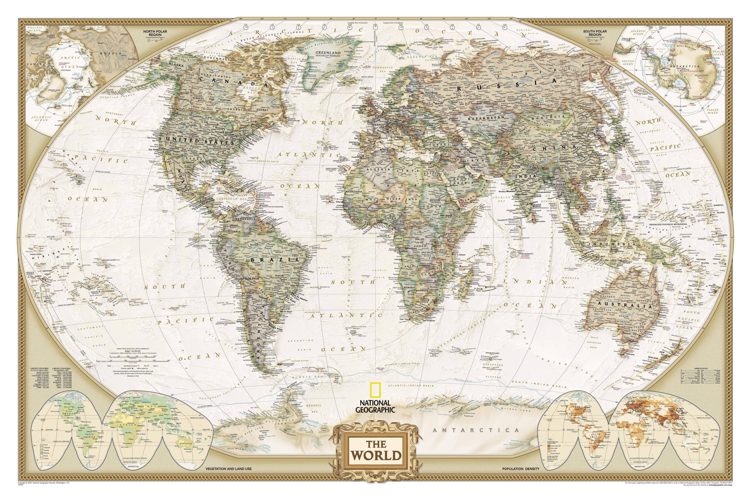
World map published by National Geographic magazine in 2007.
The general map uses the Winkel-Tripel projection to achieve a political representation of the world. The two poles appear in the upper corners, represented by the equidistant azimuthal projection. In the lower corners, there are two world maps representing vegetation and population density.
You can read more about map projections in this newsletter article: Cartographic projections: distorting the Earth in order to represent it
Sources

