Relief map of Germany, by Miguel Valenzuela (2021)

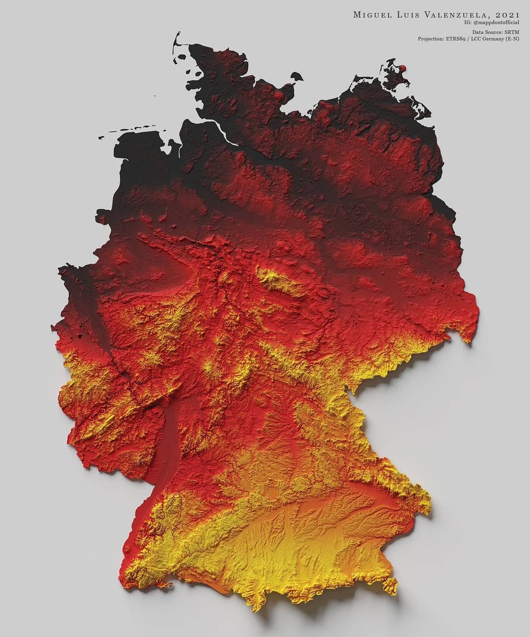
This map, created by Miguel Valenzuela, shows the relief of Germany. He uses three colours: black for the lowlands, red for the mid-altitude regions and yellow for the high peaks, simulating the colours of the German flag. In addition, the author uses shading, which makes the rugged areas stand out.

Sources


If you like maps, don't hesitate to sign up for the newsletter (Spanish o English) and collaborate with the project. With the subscription, completely free of charge, you can have access to all the maps in the catalogue in high resolution.

Milhaud Maps Newsletter Newsletter A Cartographer's Tale