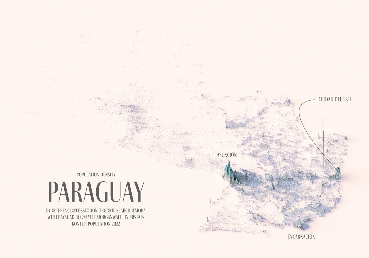
This illustration, created by Terence Teo, represents Paraguay's population density on a three-dimensional map. To do this, Terence extracted the data available at Kontur Population with which it generates columns using a programme, with a height that represents the population density at each point.
This map of Paraguay shows three large population peaks around the country's most populated cities: Asunción, Ciudad del Este, and Encarnación. More than half of the country's population lives in these three metropolitan areas.
Sources

