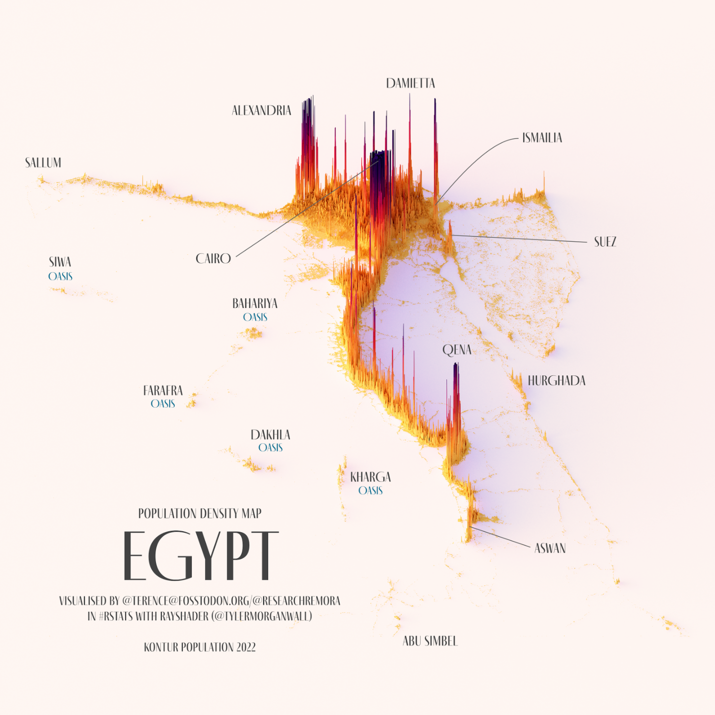
This illustration, created by Terence Teo, represents Egypt's population density on a three-dimensional map. To do this, Terence extracted the data available at Kontur Population with which it generates columns using a programme, with a height that represents the population density at each point.
This map of Egypt shows the great importance of the Nile River and its delta, as more than 95% of the country's population is concentrated throughout this territory. The delta is home to the two main cities, Alexandria and Cairo, whose urban agglomerations account for more than a quarter of the country's population. The importance of the Suez Canal can also be seen, with the city of Suez at the entrance from the Red Sea, Port Said at the entrance from the Mediterranean Sea, and Ismailia in the central part of the canal.
Sources

