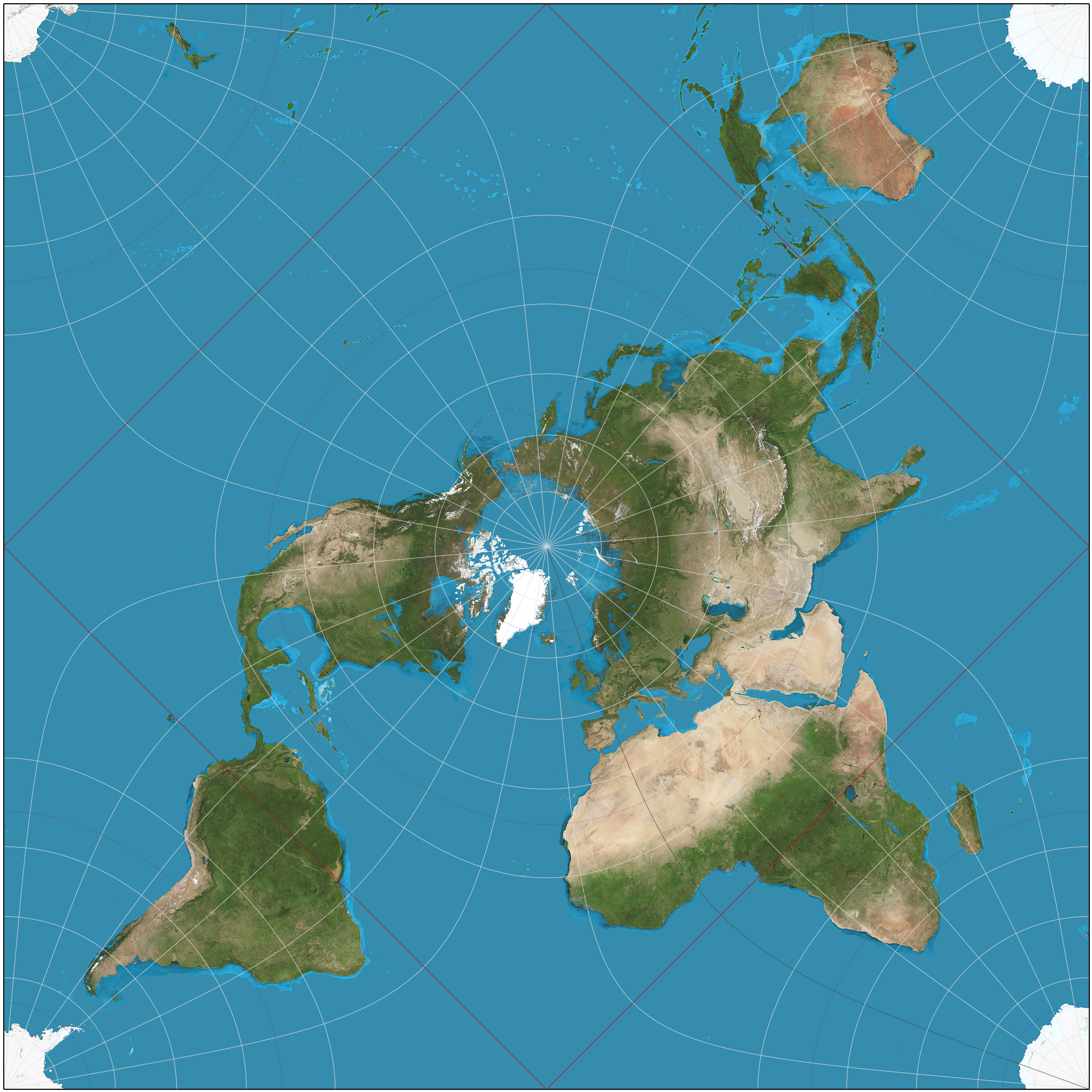
This map, created by Wikimedia Commons user Strebe in 2012, shows the world represented using the Peirce Quincuncial Projection.
This projection was defined by Charles Sanders Peirce in 1879, and with it he sought a projection that preserved angles and shapes, known as a conformal projection, on a square surface. With this solution, Peirce achieved conformity in much of the representation, although it can be seen how it fails significantly on the four sides.
In this representation of the world, the equator has a rectangular shape, such that the northern hemisphere is continuous, while the southern hemisphere is completely broken up. Apart from its visual and mathematical interest, the projection has had few uses throughout history, perhaps the most notable being by airlines to represent air routes.
You can read more about map projections in this newsletter article: Cartographic projections: distorting the Earth in order to represent it
Sources

