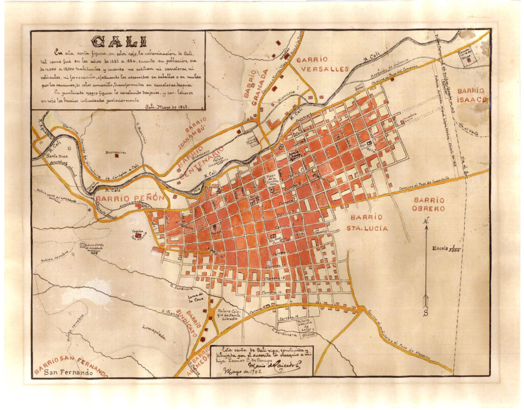
This map, published by Mario de Caicedo Lozano in May 1942, shows the city of Cali between 1882 and 1884, as well as some changes that took place in the city up until the year the map was published. Mario de Caicedo based his work on a previous hand-drawn map, of which no copies currently exist.
In the legend, the author notes the following:
- The area of Cali between 1882 and 1884, when the city had a population of around 15,000 inhabitants, is marked in red.
- The roads that had already been converted into motorways by 1942 are shown in yellow.
- A dotted black line marks the extent of the city of Cali in 1942.
- The names in red show the different neighbourhoods that were built between 1882 and 1942.
Sources

