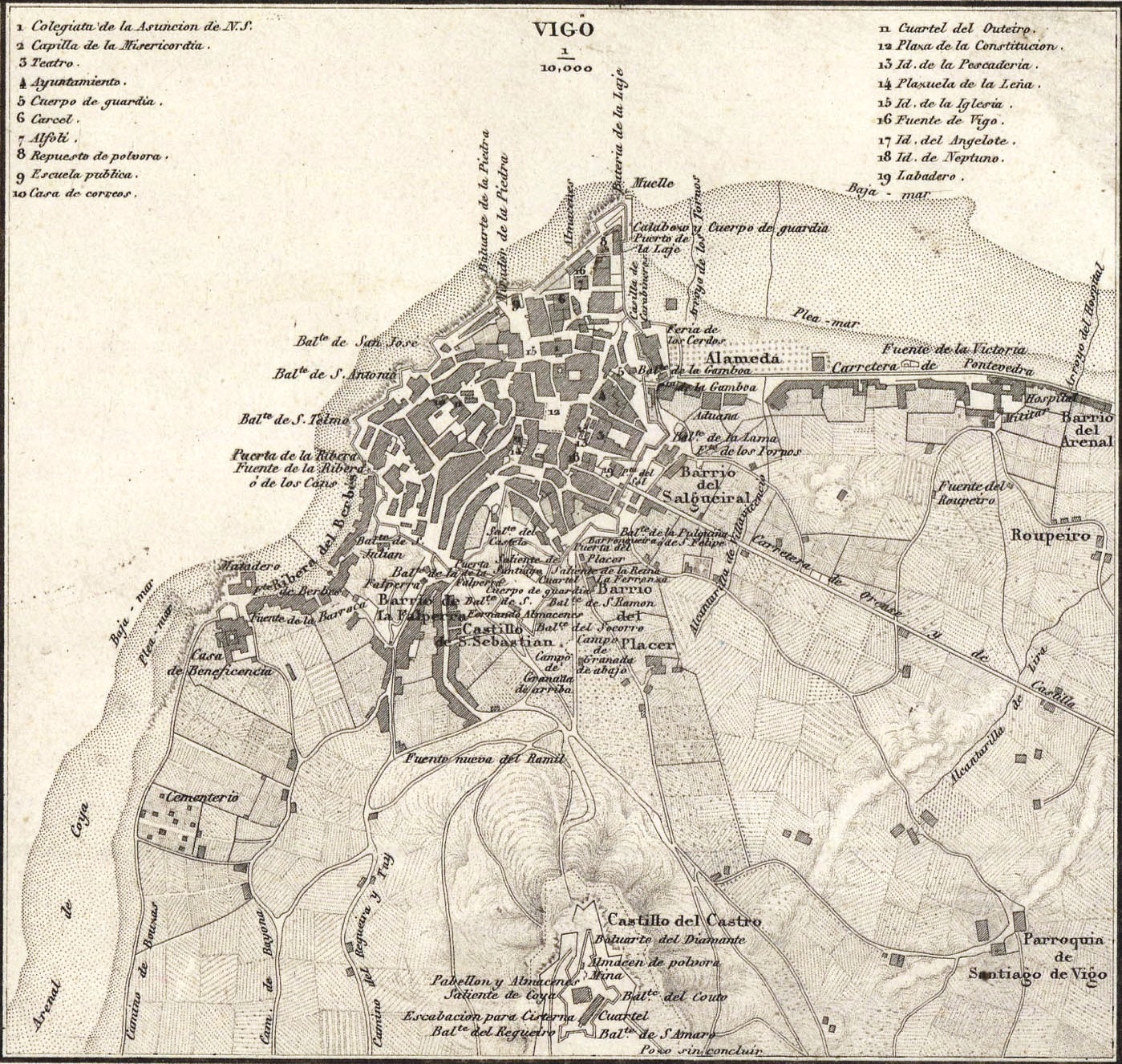
This map of Vigo was published in 1856 by Francisco Coello. It forms part of a larger map of the province of Pontevedra, with some of the main towns and areas of the province shown in the corners and at the bottom.
The map shows the old wall of Vigo, built in 1665. It had a total of six gates along its entire perimeter: Puerta del Placer, Puerta del Sol, Puerta da Gamboa, Puerta da Laxe, Puerta da Ribeira and Puerta de Falperra. In 1881, the municipal council decided to demolish the wall to accommodate the expansion of the city.
Sources

