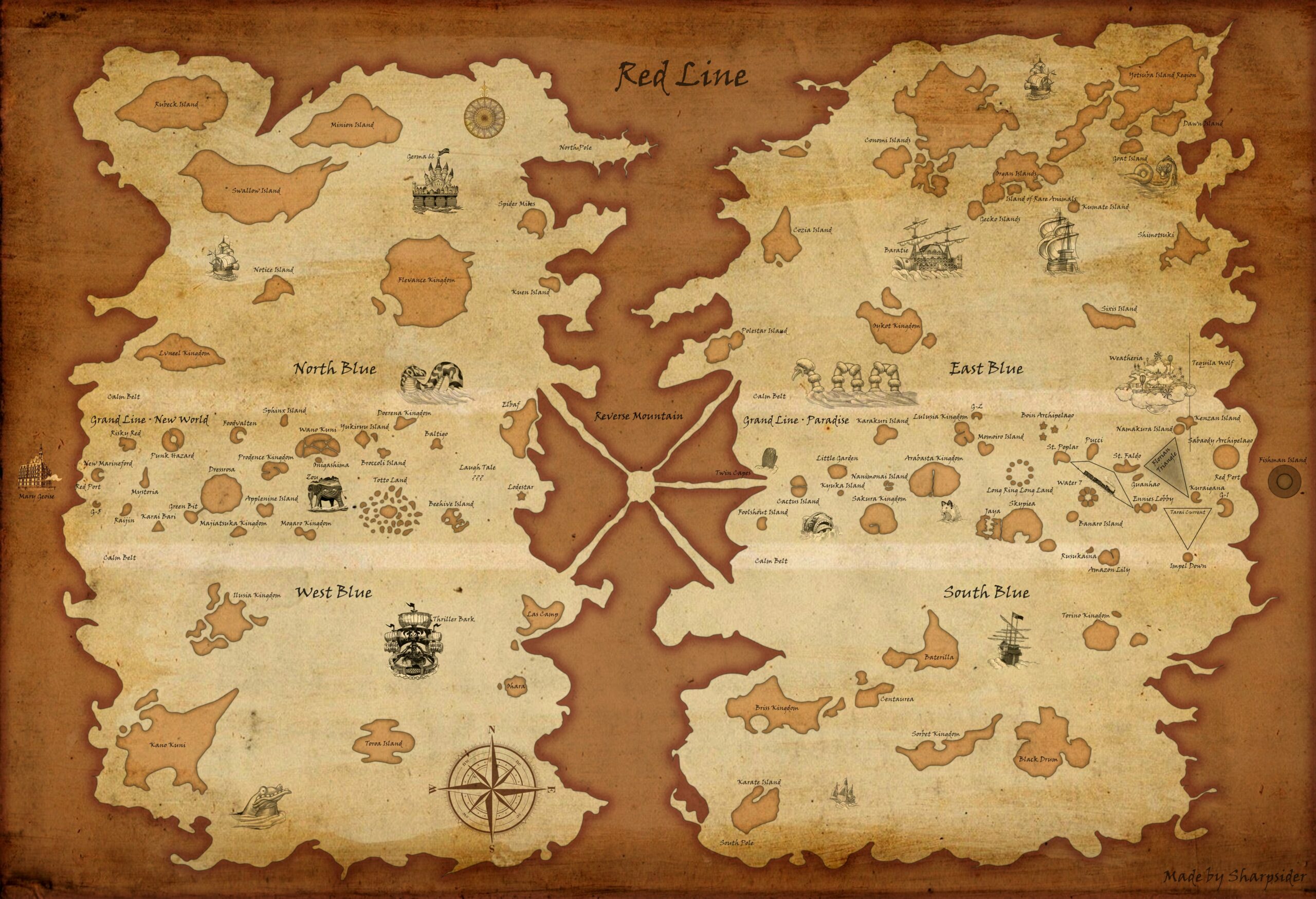
This is a map of the world of One Piece, created by a DeviantArt user. Sharpsider, based on the information available in the manga, as well as maps previously created by other authors.
This illustration is a representation of the world described in the manga and anime One Piece. The map is a representation of the planet, with the following significant areas:
- Red Line: This is the only continent in the world, a mountainous line that encircles the entire planet.
- Grand Line: This is a sea that runs along the equator of the world of One Piece, a place where extraordinary things happen.
- The four oceans that divide the world: the Red Line and the Grand Line:
- North Blue or North Sea.
- West Blue or Western Sea.
- East Blue or Eastern Sea.
- South Blue or South Sea.
The map also depicts most of the islands that appear in the various manga sagas, in accordance with the available details.
Sources

