
This map, created by Miguel Valenzuela, shows the relief of Bangladesh. It uses two colours: dark green for areas...
Maps of Bangladesh

Linguistic map of Hindustan (1978)
This map, edited by Joseph E. Schwartzberg in 1978, is part of A Historical Atlas of South Asia (An atlas...
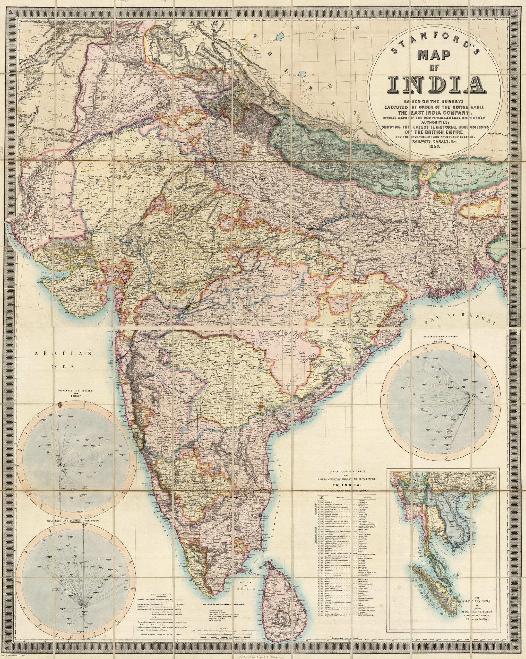
Map of India (1859)
This map was published by Stanfords, a London-based publisher, in 1859. The map details the territorial politics of the Indian subcontinent, according to...
 Español
  English (UK)