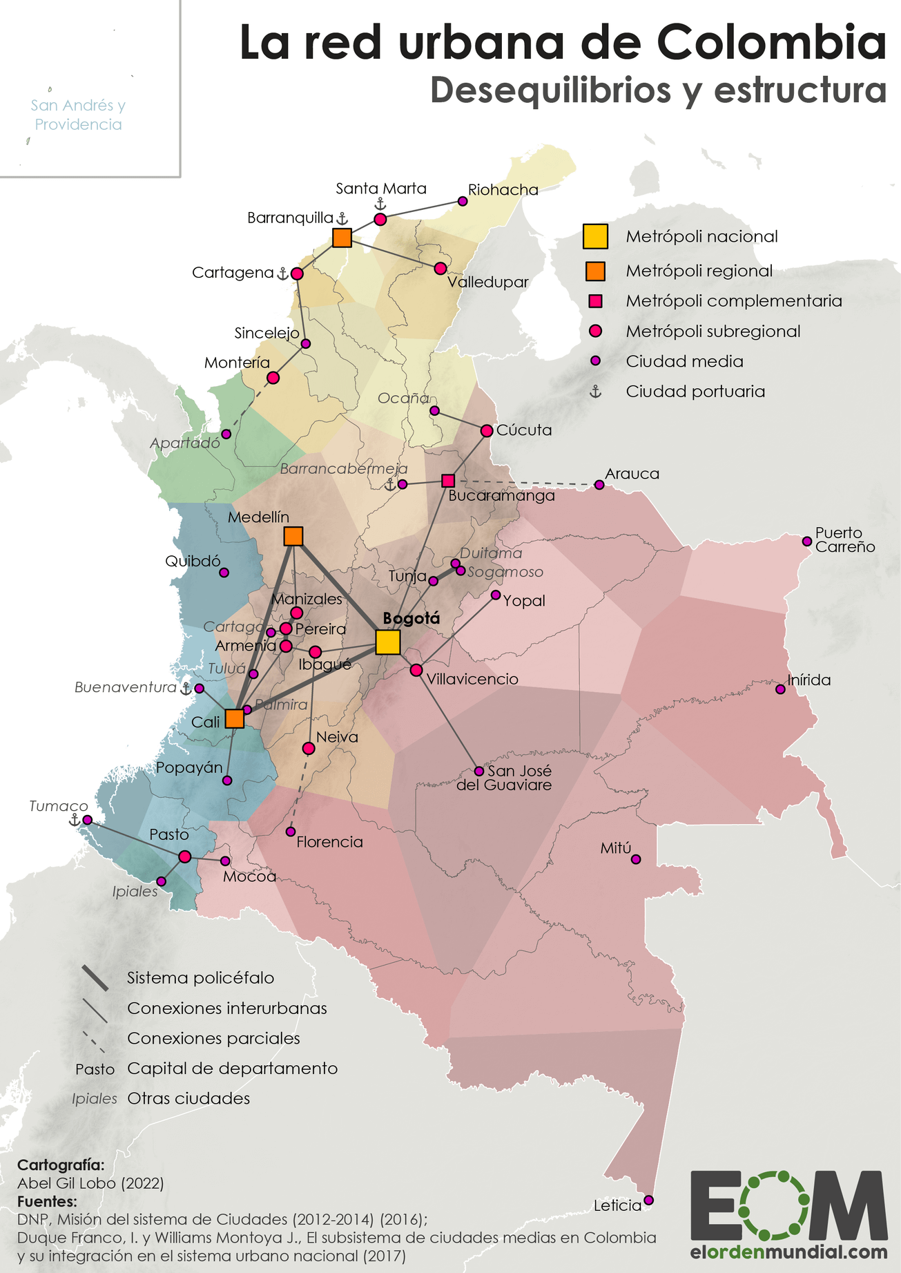
This map, created by Abel Gil Lobo for the website El Orden Mundial, represents Colombia's urban network.
The illustration shows the different cities categorised by their relative weight:
- With a yellow square, the national metropolis.
- With orange squares, the regional metropolises.
- With a pink square, the complementary metropolises.
- Subregional metropolises are marked with a pink circle.
- Medium-sized cities are marked with a purple circle.
In addition, all the cities are linked with different lines, depending on the interconnection between them. Colombia's main weight is focused on the golden triangle, which is the name given to the region between Bogotá, Cali and Medellín. Within this triangle is grouped 50 % of Colombia's population, as well as more than 75 % of the national GDP.
In addition to the golden triangle, Barranquilla, in the Caribbean region of the country, is also an important centre of economic activity. During colonial times, Cartagena de Indias was the most important city in this area, but this began to change at the end of the 19th century, partly thanks to new infrastructure built in Barranquilla that facilitated the city's industrialisation and trade. Until the 1970s, Barranquilla maintained an important connection with the Golden Triangle, but this has declined in recent decades.
Sources

