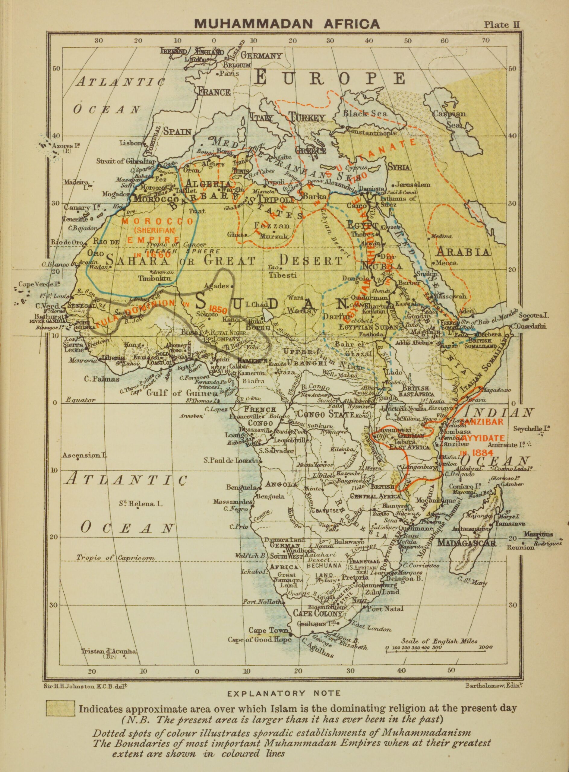
This map, created by the Scottish cartographer John George Bartholomew and published in 1899 as part of the book by Harry Hamilton Johnston A History of the Colonisation of Africa by Foreign Races (A history of the colonisation of Africa by foreign races).
The book was created in the context of the struggle between European colonial powers to divide up Africa. This particular map shows the presence of Islam on the continent at the time of its publication. All the territory with a yellow hue, mainly the Sahara, North Africa and the Middle East, determines the extent of this religion at the end of the 19th century.
Above the yellow colour there are also red lines tracing the territory of the most important Islamic empires at the time of their maximum extension, among them:
- The Sultanate of Zanzibar in 1884.
- The Ottoman Empire in 1750.
- The Jerifian Empire (Morocco) in 1660.
- The Khedivate of Egypt in 1882.
- The Sokoto Caliphate in 1850.
The purpose of this map, in depicting Islam in Africa, is not religious but geopolitical. The northern part of Africa and the Middle East had been controlled by Islam, and with it also the trade routes to the Indian Ocean and East Africa. Understanding the network of previous powers could be useful for European colonisers in their African campaigns.
Sources

