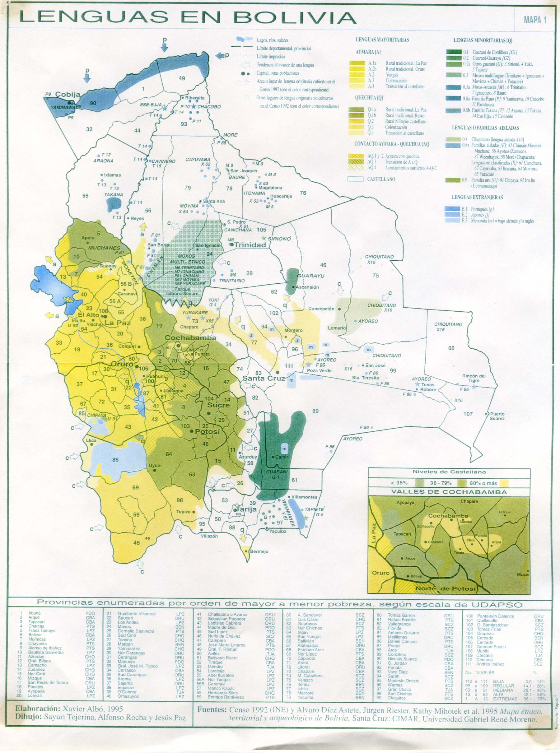
This map, by Xavier Albó Corrons, was published by the Centro de Investigación y Promoción del Campesinado (CIPCA) in 1995, as one of the maps included in the book Multilingual Bolivia: a guide for planners and educators.
The map shows the complex linguistic diversity of Bolivia, using different colours for the different languages, as well as the transition areas between them. The most important ones shown are as follows:
- Spanish, the entire blank region of the map.
- Quechua, The olive, with areas of transition to lighter-toned Castilian.
- Aymara, The gold, with areas of transition to lighter shades of Castilian.
- Tupi-Guarani languages, in greenish colours.
This map, and the work that contains it, was published just one year after Bolivia's Education Reform Law, when bilingual education was introduced as a state policy in the country. In order to implement it effectively, it was necessary to understand in which regions the different indigenous languages of Bolivia were spoken. This Albó map was the first detailed linguistic map to be drawn up for educational planning in the country.
Two years after the publication of this map, in 1997, Quechua, Guaraní and Aymara were established as official languages alongside Spanish. The 2009 constitution raised the number of official languages to 37, incorporating more minority indigenous languages.
Sources

