
This illustrated map, published by Lara Romero in 2021, shows the island of Fuerteventura in the Canary Islands. The map includes the…
Maps from 2021 (96 maps)

Territorial organisation of Spain in the 18th century (2021)
This map, published as part of the National Atlas of Spain in 2021, shows the territorial organisation of Spain during the...

Homicide rate in Latin America and the Caribbean (2021)
This map, published in 2022 by Deutsche Welle with data from InSight Crime, shows the homicide rate per...
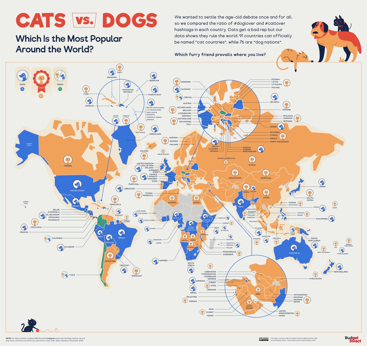
The World of Dogs and Cats (2021)
The map, created by Budget Direct in 2021, shows the preference for dogs or cats around the world. The...

Relief map of Madagascar, by Miguel Valenzuela (2021)
This map, created by Miguel Valenzuela, shows the relief of Madagascar. It uses two colours: green for low-lying areas...
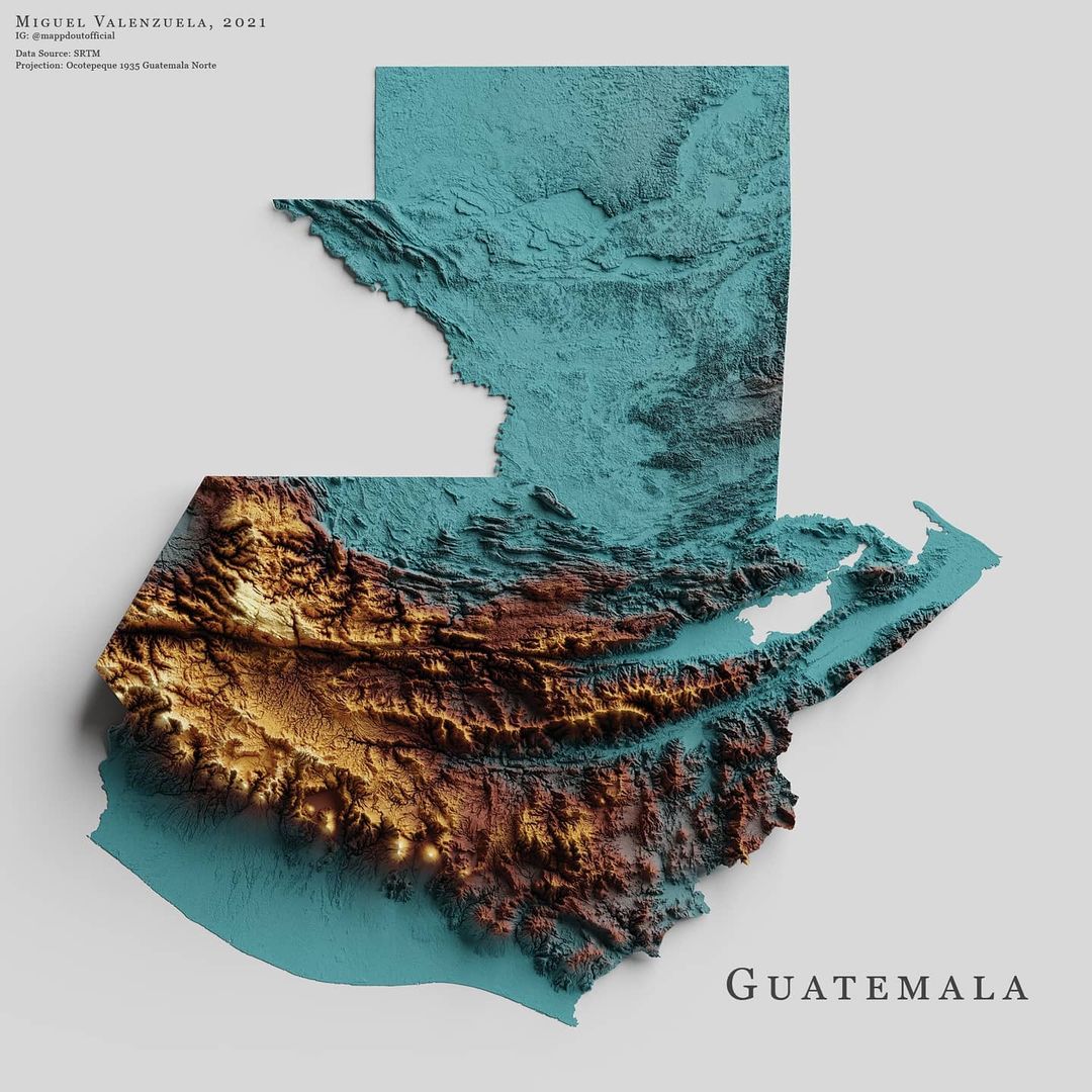
Relief map of Guatemala, by Miguel Valenzuela (2021)
This map, created by Miguel Valenzuela, shows the relief of Guatemala. It uses three colours: blue for low-lying areas,...

Relief map of Ethiopia, by Miguel Valenzuela (2021)
This map, created by Miguel Valenzuela, shows the relief of Ethiopia. It uses two colours: green for low-lying areas...

Map of urban areas in Spain (2021)
This map is part of the Statistical Atlas of Urban Areas, published in 2022 by the Ministry of Transport of...

Life expectancy worldwide (2021)
This map, published by Our World in Data, shows life expectancy in different countries around the world. To...
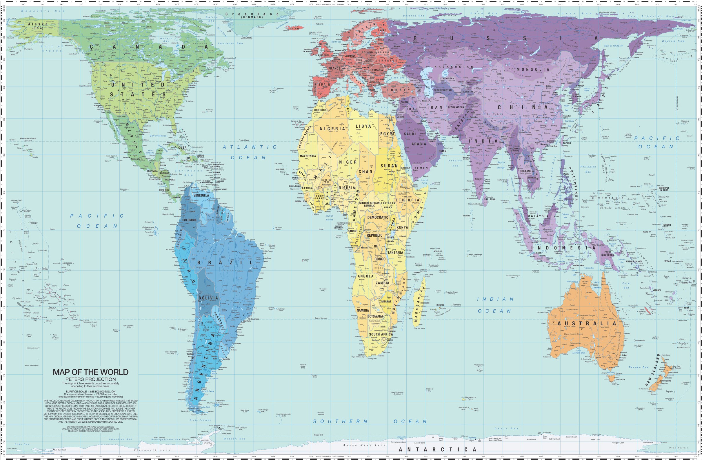
World map, Peters projection (2021)
Gall-Peters projection map with political boundaries for 2021. This projection was originally conceived and published by...

Relief map of Mexico, by Miguel Valenzuela (2021)
This map, created by Miguel Valenzuela, shows the relief of Mexico. It uses three colours: green for areas...
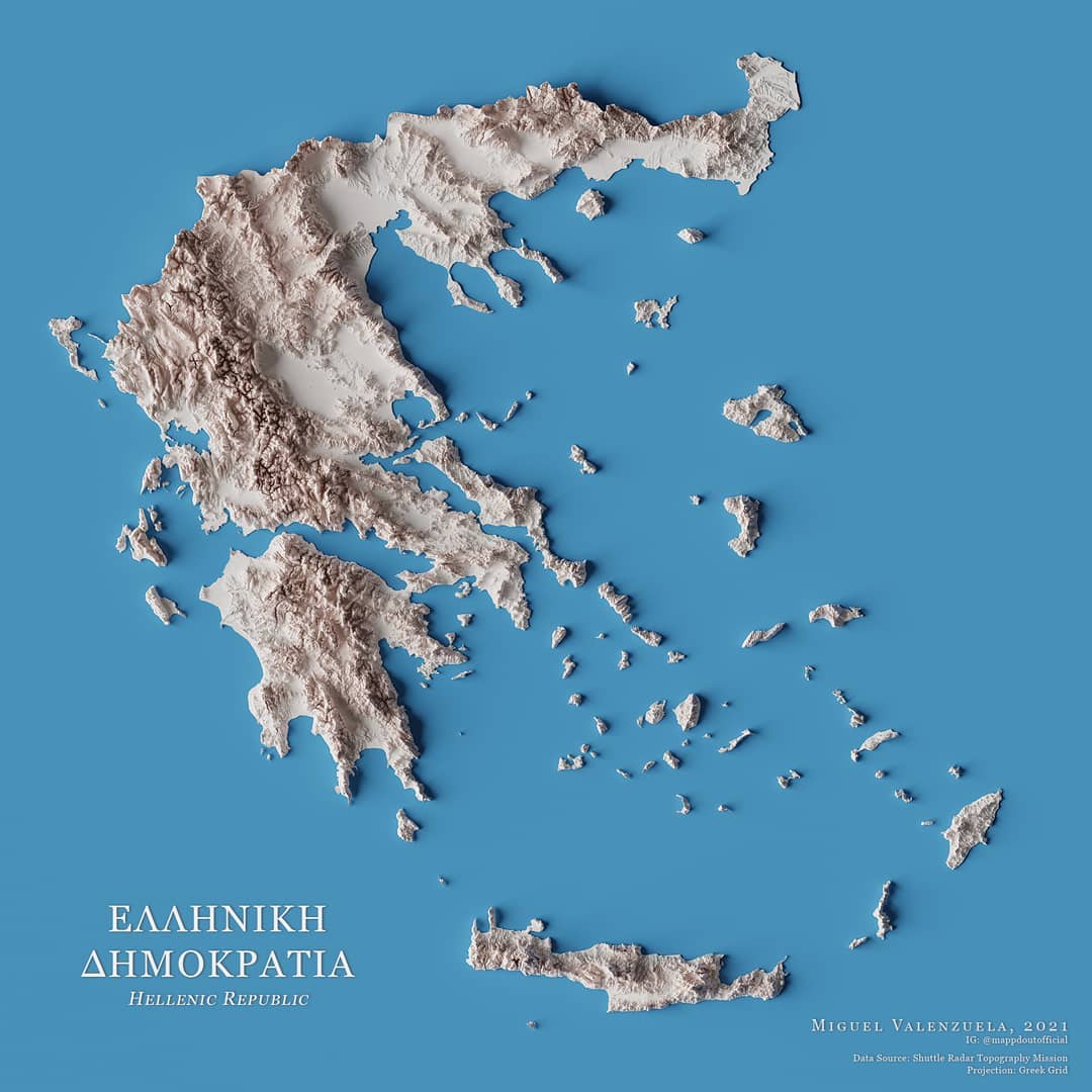
Relief map of Greece, by Miguel Valenzuela (2021)
This map, created by Miguel Valenzuela, shows the relief of Greece. To do this, it uses a range of whites with which...
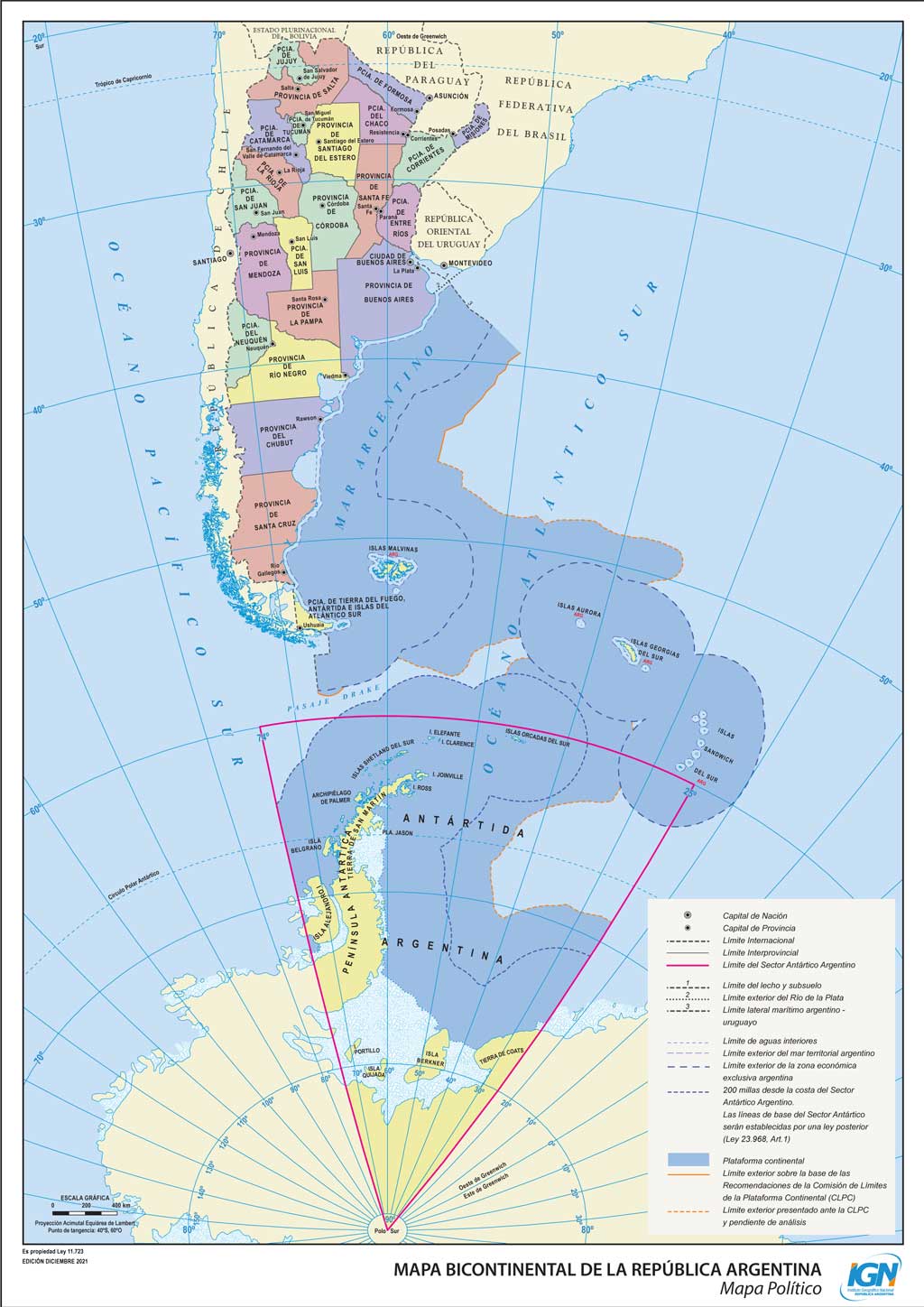
Bicontinental map of the Argentine Republic (2021)
This map, published by the National Geographic Institute of the Republic of Argentina, is the official map of the nation.

Political map of the Caribbean (2021)
This political map of the Caribbean and Central America was created by Abel Gil Lobo for the website El Orden Mundial in 2021. In the...

Relief map of Greenland, by Miguel Valenzuela (2021)
This map, created by Miguel Valenzuela, shows the relief of Greenland. It uses two colours: blue for low-lying areas...

Ethnic map of Colombia (2021)
This map, created by Reddit user Danishmapper, shows the distribution of ethnic groups in Colombia, according to self-identification provided...
 Español
 English (UK)