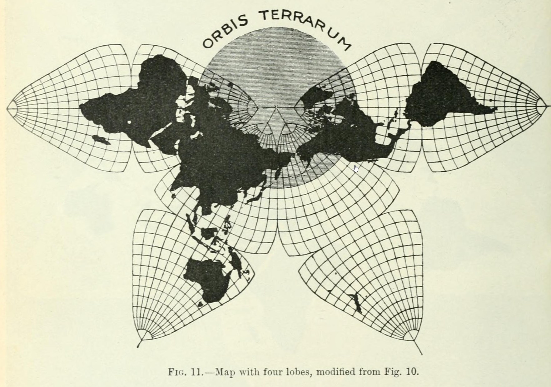
This map was published by the architect Bernard J. S. Cahill in 1909 as part of his article An Account of a New Map of the World, in The Scottish Geographical Magazine. Cahill was not a geographer; he simply developed this projection as part of his hobby of maps and cartography.
In the article, Cahill devotes a large part to quantifying the problems with the Mercator projection and the need for an alternative that provides a better representation of areas and does not suffer from the polar distortions of cylindrical systems. In his solution, Cahill divides the world into 90° sectors of longitude and, for each of these, defines a cone tangent to the sphere. By unrolling these cones, he obtains the eight spherical triangles which, when joined together, form the first butterfly map.
This 1909 version marks the first time this map was exhibited in public, three years before it acquired the nickname by which it is known today: the ‘butterfly map’. In the article, Cahill also acknowledges the map’s flaws, such as distortions in the equatorial regions in places like Guinea, Australia, Brazil and India.
The authorised version of this projection, which preserves the angles, was published twenty years later by Oscar S. Adams, in 1929, based on Cahill’s original design.
Sources


 Español
 English (UK)