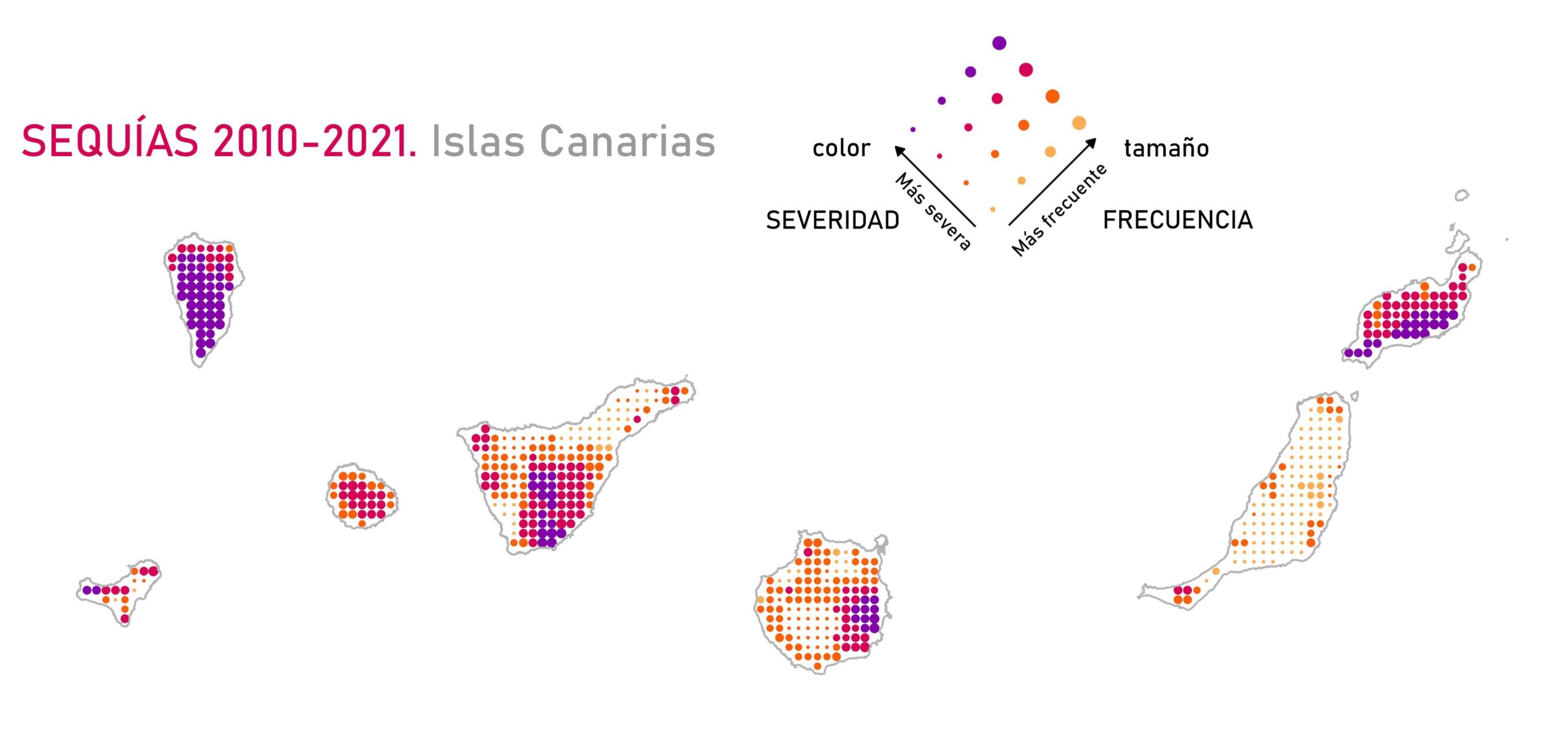
This map, created by the Spanish geographer Dominic Royé, shows the prevalence of droughts in the Canary Islands between 2010 and 2021. The data has been obtained from the database of meteorological drought indices for Spain, which is available at this CSIC website.
For representation purposes, the author divides the territory into points, which are represented by two variables. The colour denotes the severity of the drought, while the size of each point denotes its frequency.
On this other map you can find droughts in mainland Spain and the Balearic Islands.
Sources

